Orford Ness revisited
27/01/2017 | Lara Band
Some of you might remember our blog last year about Orford Ness, where CITiZAN and volunteers have been working with the National Trust and with Nadia Bartolini, a researcher on the AHRC funded project Heritage Futures. That blog looked at the fascinating history of the Ness and our work there in July and September last year. This one is our trip on Friday 20 January with our volunteers, some of whom have worked with us previously on the Ness. The purpose of this trip was to see if there'd been any damage to the features we'd recorded in the summer, following the high winds and tidal surge of 14 January. Even though the surge wasn't as bad, thankfully, as predicted we were still concerned about the features on this particularly fragile and dynamic strip of Britain's coast.
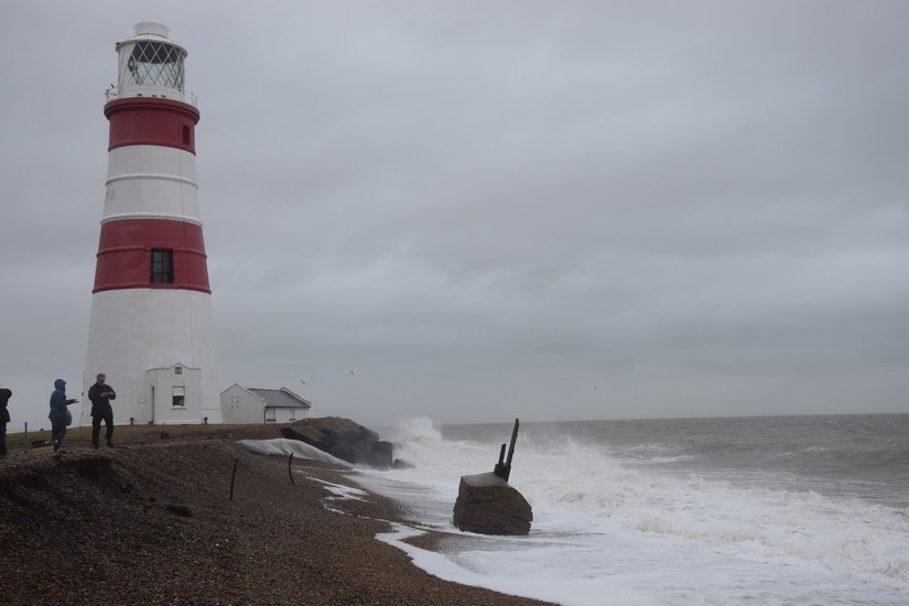
With an early start on Friday, and having been out at Mersea Island, Essex on Thursday, the CITiZAN South East team, CITiZAN project Officer Stephanie and Nadia stayed the night before in The Jolly Sailor, a lovely pub right near Orford Quay. The day dawned beautifully, and our luck held out with glorious weather all day.

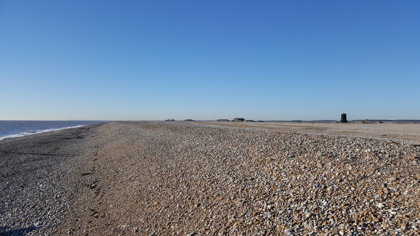
Compare, below, a photograph taken on Friday with the one taken on a reconnaissance trip we made in January 2016 with Nadia, to meet with the National Trust. The horizontal rain and near freezing conditions that day were challenging, though in no way dampened our enthusiasm for working on such a bleakly beautiful and historically interesting part of the coast. This January the weather couldn't have been more different. Though cold, the clear blue sky and bright sunshine meant we were even a little sunkissed by the end of the day. Such extremes of weather, at the same time of year really brings home the unpredictability of discovery and loss of Britain's coastal heritage, and the importance of monitoring coastal and intertidal zones.
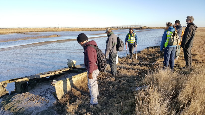
Our first port of call on the Ness was the wing of an aircraft lodged in the salt marsh of Stony Ditch, the tidal creek that cuts Orford Ness in two. It may have washed into the creek from the Lethality and Vulnerability Testing site during the 1953 flood. The type of aircraft the wing came from is as yet unconfirmed, though Avro Lancaster, Avro Lancastrian and Sterling bomber have all been suggestions, Since our last visit the wing has become more exposed; we also spotted what may be further sections of the wing lying higher up in the salt marsh: see the update on our interactive map.
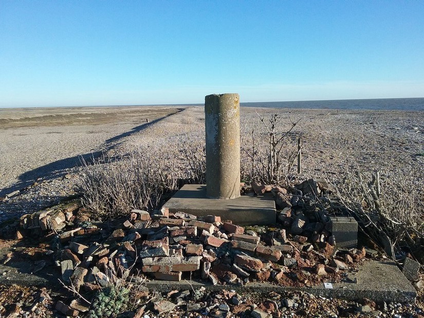
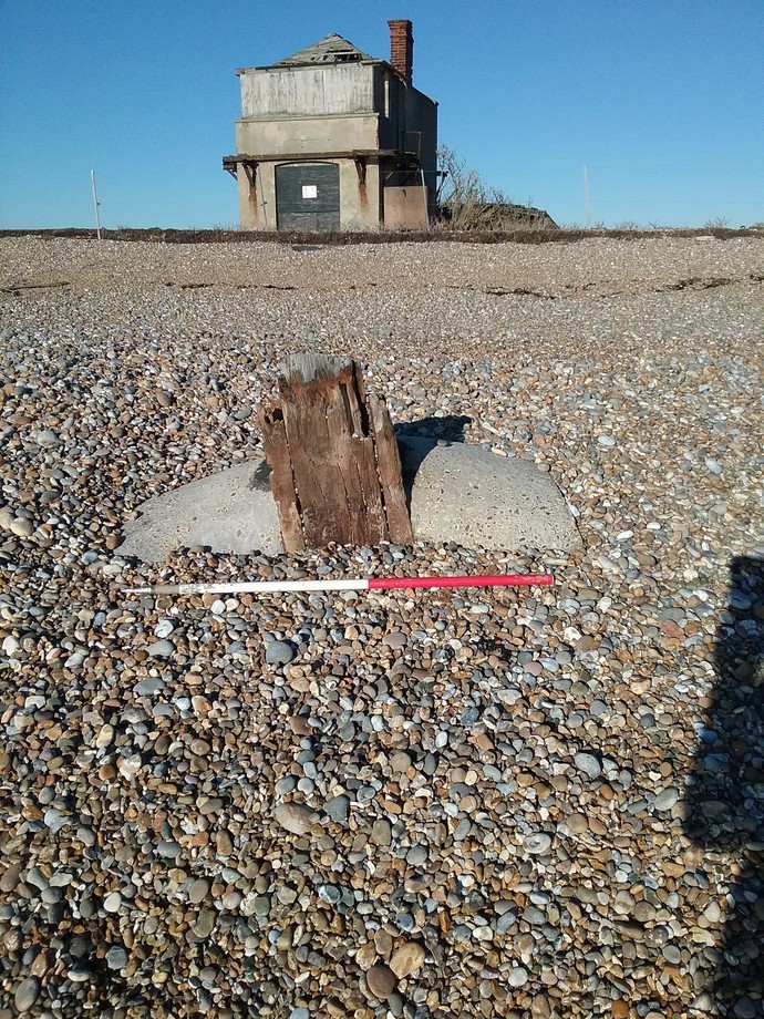
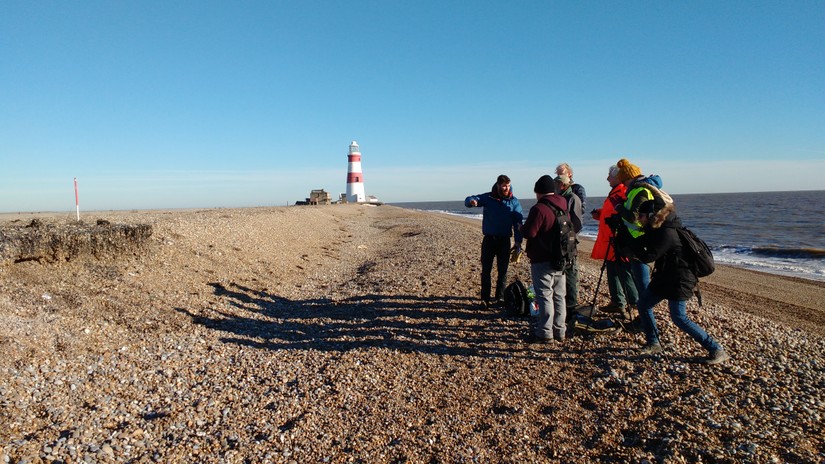
We then walked towards the lighthouse, where volunteers updated the CITiZAN map entry for a kine theodolite base. Kine theodolites were used to gather trajectory data during ballistics tests and were often operated by ATS personnel, as depicted in this great British Movietone clip from 1940. After updating map entries for the lighthouse we went to check on the Coastguard station site. This includes the watch house, concrete structures built by the Admiralty post Second World War for an as yet unknown purpose (if you have any ideas please get in touch) and the remains of a flagpost. The storm of the previous week had not caused too much damage but had thrown more shingle up around the features. In fact, compare the photograph of the flagpost below, with the one taken in January 2016 above, for an excellent example of just how dynamic the coastline is at Orford Ness: how much the shingle can both erode and accrete.
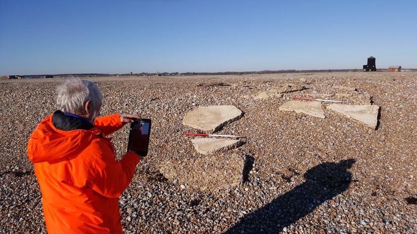
We then walked along the shoreline keeping below the extremely sensitive shingle habitat to check on the black and white target eroding out of the shingle shelf. This is the most fragile feature we've been monitoring. Made of tar and a lime slurry poured directly onto the shingle, it has suffered quite a bit since our last visit, with perhaps only a quarter of the target now left. The police tower base too, a simple concrete slab with no obvious foundations appeared to have slid a little further down the shelf.
As with so many of the sites we work on, and as with so many of the heritage assets along our coastline and estuaries, we can't save these features from the power of the sea but by recording them we can, as the phrase goes, 'preserve by record'. This allows both ongoing study and the creation of a record to be used as a proxy to measure coastal erosion. Our work for the day done we walked back to Orford Ness quay, and after a ride back in the National Trust ferry took a well earned lunch at the Riverside tearoom. A report on our work on Orford Ness is forthcoming and more images of our adventures on Orford Ness over the last year can be seen on our Flickr stream. We're planning a return this summer with details to be confirmed; lets hope the weather is as kind to us next time!