A Humber Perspective: Paull
06/06/2022 | Angus Stephenson
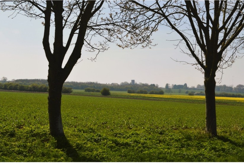
In the summer of 1991 on my 40th birthday I found myself monitoring the archaeological effects of the construction of a gas pipeline from the North Sea gas terminal at Easington on the east coast of Yorkshire to a control installation at Paull about 15 miles to the west, on the eastern edge of Hull. The agricultural land around here is very flat, and I found myself watching skylarks rising above the yellow fields of rapeseed in a landscape with a backdrop of distant medieval churches.
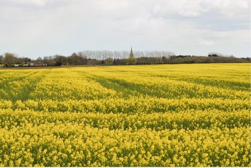
Rapeseed fields near Ottringham © Angus Stephenson.
The reason why the land is so flat is because the northern bank of the tidal Humber estuary was a few miles north of its current line from prehistoric times until the post-medieval period. If you drive along the modern A1033 from Hull towards Spurn Head, you will pass through a series of villages, often with apparently disproportionately grand medieval churches, on slight rises surrounded by flat farmland. The land to the south between the villages and the modern riverbank is land reclaimed from the tidal marshes of the Humber,usually from about the17th century onwards.In the medieval period the villages were relatively prosperous, thriving on the maritime wool-transporting trade between Yorkshire and the south-east of England and the continental Low Countries, the profits of which helped fund the ambitious church construction schemes. Hedon and Patrington can probably claim the most spectacular churches and the names of their port areas, Hedon Haven and Patrington Haven, survive to this day, although they are now several miles inland.
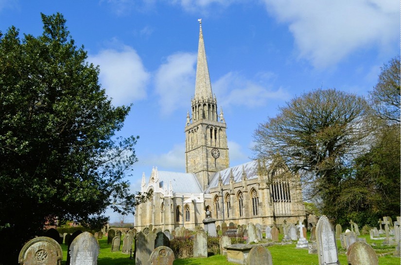
Patrington Church © Angus Stephenson.
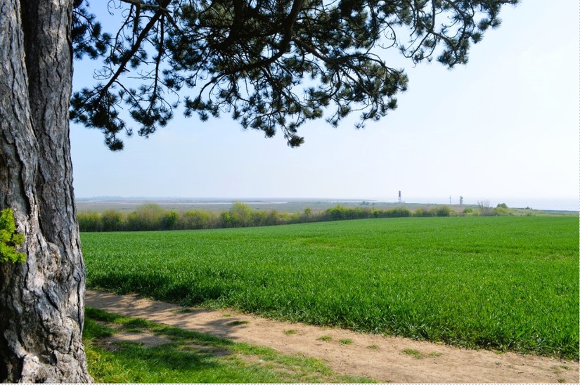
The reclamation of the land from the Humber was often carried out by a process known as warping, whereby artificial banks were built to catch the silt particles suspended in the tidal waters, but the story did not stop when this had been done successfully. Care had to be taken to make sure that the new ground was not immediately washed away again. The east coast of Yorkshire is notoriously one of the fastest eroding coastlines in Europe, with several metres lost every year and at least 30 known villages have disappeared into the sea around here, of which Ravenspur near Spurn Head is probably the most famous name. Coastal protection is still needed not just as far up the estuary as Paull, but beyond to Hull and Hessle beside the Humber Bridge. In recent times one measure increasingly used for protection has involved shipping huge quantities of hard Scandinavian rock to Britain for dumping on the foreshore as rock armourto prevent erosion, as well as the more routine sea walls, which are first mentioned in the area in the 13th century.
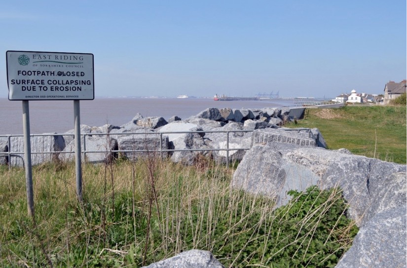
Rock armour and erosion warning, Paull © Angus Stephenson.
The problem of coastal erosion is getting worse and there was considerable damage done by North Sea storm surges in 2013, when the road connecting Spurn Head to the mainland was washed away and anewtidal island was effectively created. “Prepare yourselves, this is serious,” said a spokesman for Humberside Fire and Rescue, as the biggest tidal surge for 60 years approached. It is not a new problem, however. The original church of Paull was built on the banks of the Humber by the 13th century at least, and probably much earlier, but by 1355 it was subject to “inundation” and the decision was taken to move it uphill on to higher ground. The church’s exact original position is not known, although it was somewhere along the foreshore beside the erosion warning in the photograph, where the Humber Historic Environment Record locates it. The new 14th century church was begun to be built of limestone and ashlar but was finished off with brick and cobble. “The money must have run out” as Pevsner and Neave laconically put it. The new location is locally known as High Paull and is on top of a low ridgearound the 12m OD mark, not exactly comparable to the Himalayas but sufficiently elevated to lift it out of the flood plain.
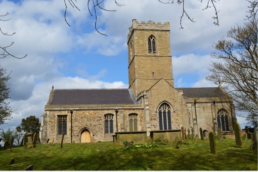
St Andrew’s Church, Paull, 14th century © Angus Stephenson.
The tower of St Andrew’s Church, High Paull © Angus Stephenson
The eastern part of the gas pipeline being constructed in1991 ran for the most part through the land reclaimed from the marshes and was predictably sterile from an archaeological point of view. There was nothing archaeological to be found in the upper deposits apart from a few prehistoric flints on the slightly higher ground near Easington but at the western end near Paull the picture was different. At Boreas Hill the ground rises noticeably,with the upper parts being a little above the 10-metre contour line, and here there was a substantial prehistoric settlement, represented by pits, postholes and ditches with pottery and flintsprovisionally dated to the Iron Age,animal bones and wood and other cultural material.
The flat land of Paull Holme strays looking east from Holme Hill ©Angus Stephenson.
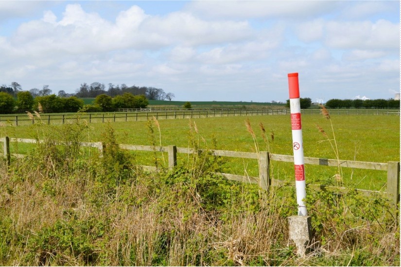
High pressure gas transmission mains are potentially dangerous things. Nowadays the gas companies put up red and white poles marking the route of the pipes, as seen in the next photo of the land at the bottom of Boreas Hill. These have helpful cartoons on them to convince farmers not to blow themselves up, along with half of East Yorkshire, by putting JCB buckets through the pipes.
Gas pipeline route near Boreas Hill, Paull© Angus Stephenson.
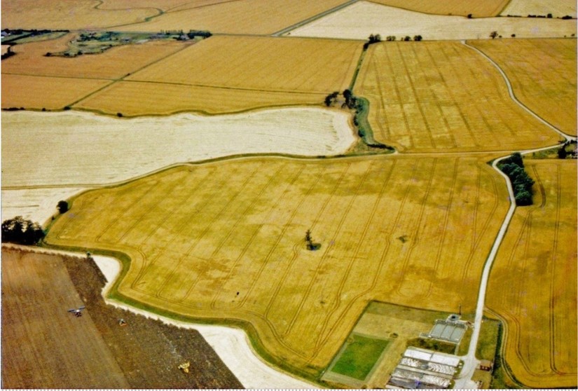
Thirty years ago British Gas had a different approach to warning off farmers and others from damaging their pipes and sent pilots and observers in helicopters to patrol the routes and swoop down from the sky on potential malefactors. I used to be sent along to take archaeological photos of the cropmarks and soil marks and so on along the way and the next photo is one of those. The original slides are housed with the Humber Historic Environment Record. It shows Boreas Hill Farm behind the trees and the mass of amorphous cropmarks in the central field represent the prehistoric settlement. The photo was taken in July 1991 a few weeks after the reinstatement of the land through which the metre-or-so wide pipeline trench was cut. I have added the red lines to show the route of the pipeline construction corridor and an orange lineto show the approximate position of the pipe trench.
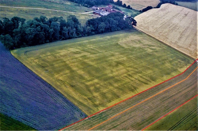
Cropmarks at Boreas Hill, Paull, looking south-west, July 1991© Angus Stephenson.
Needless to say, this was a long time before digital cameras and drones were commonly used in archaeology, and nowadays you would not need to have an archaeologist hanging out of the back window of a chopper trying to change a slide film in a camera whilst travelling at over a hundred miles an hour. The main purpose of this article is to suggest that someone might like to devise a research project for a more systematic drone survey of the settlements on the former islands in the marshes in the fields in this area, and possibly some non-intrusive geophysical survey, which would be relatively cheap and cost-effective and need not be dependent on the vagaries of gas inspectors’ flight schedules or upset local landowners unduly.
In 1995 the Humber Wetlands Project basedat the University of Hull published a book called “Wetland Heritage of Holderness”, commissioned by English Heritage, which says at p. 241: “Paull: The landscape around Paull is one of marked contrast between the very flat, low-lying alluvium (c. 2-3 m OD) and the hills (comprising glacialtill and Kelsey Hill Beds) which protrude through them (e.g. High Paull, Boreas Hill, Checker Hill, Rose Hill, Holme Hill). The findspots are all restricted to theseoutcrops of pre-Holocene deposits.” The project did, indeed, record a small but steady trickle of prehistoric flints recovered from field-walking from these areas, so that it seems that there was at least some prehistoric occupation of most of the glacial moraine islands in this part of the Humber estuary.
The next photo illustrates how a few days can make all the difference to recording cropmarks. It shows one of the fields around Rose Hill looking north. Cropmarks can be seen near the trees in the centre right of the picture in the field with the single tree in it, and around its edges,but generally the crops have ripened a little too much, so that nothing conclusive can be seen in the centre of the field. Metal detectors have also found a Roman silver ring in this field. In the next field to the north towards the top right of the picture, 124 pieces of struck flint provisionally dated to the Neolithic and Bronze Ages have been found in two distinct scatters, as well as a medieval buckle and a hoard of 5 Tudor coins. Immediately beyond that to the north, the light yellow field at the top right of the photo was the site of St Mary Magdalene’s medieval leper hospital, from which vast quantities of medieval pottery have been recovered by field-walking.
Cropmarks at Rose Hill, Paull looking north, July 1991 © Angus Stephenson.
Cropmarks, old and new, East Yorkshire, July 1991© Angus Stephenson.
Paull is well and truly off the beaten track. Not too many visitors head for it as tourists and the industrial horror show on the horizon at Saltend in East Hull is hard to ignore, but for a while it was home to a very unusual monument and you could argue that it still is. This is Fort Paull, situated at a crucial vantage point for defending the Humber estuary with heavy ordnance. The high ground here was fortified with a gun battery to defend the approaches to Hull in Henry VIII’s reign and it played an importantrole in the 17th century Civil War siege of Hull but the most important remains date from the middle of the 19th century when it was developed as one of the “Palmerston forts”. It also played an important role in World War II as a supply station for convoys to Russia. It was closed in 1960 and taken over by the Friends of Fort Paull, who spent the next 35 years accumulating stuff to put in a museum to open to the public.The collection includedguns and artillery, redundant aeroplanes, life-size waxwork models of Henry VIII, Elizabeth II and Adolf Hitler, a 12-foot high concrete Tyrannosaurus Rex and a huge collection of Action Man toys, many of which were displayed in the gloomy Victorian ammunition bunkers.
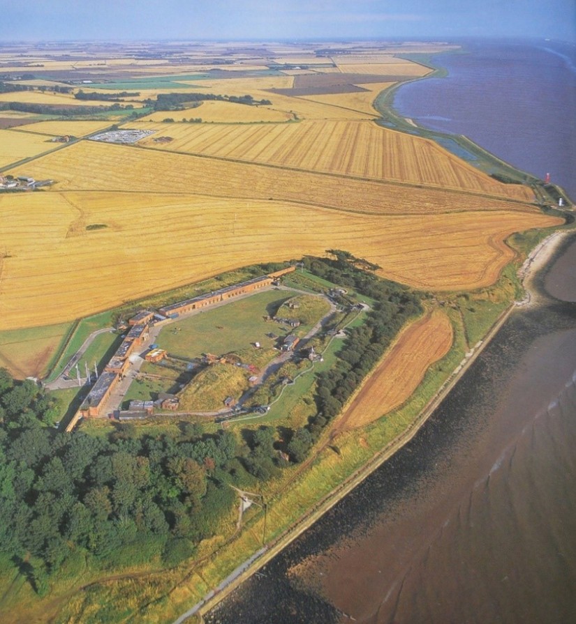
Fort Paull from the air © Jason Hawkes, from “Yorkshire from the Air”, 2001.
One of the star attractions was a Berliner railway dining car used by the occupying British and American forces in Germany during the Cold War. It is quite possible that Elvis Presley used it whilst doing his military service in Germany in the late 50s, as they used to claim. It spent its later days as the Fort Paull museum café. In 2015 the TV show “Most Haunted” did two hour-long shows there, seeing as how Fort Paull has a very definite local reputation as a spooky place, particularly among former museum staff. I couldn’t possibly advise you on how seriously to take this stuff but here is presenter Yvette Fielding talking about the alleged railcar ghosts, whilst the spirit of Elvis looks on. The shows are easily found online.
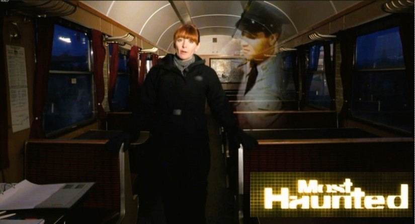
Yvette Fielding presenting “Most Haunted” at Fort Paull© Really TV (Screenshot with logo added).
Then suddenly it was all over. The owners announced in 2020 that Fort Paull would not be reopening that year owing to “unforeseen circumstances” and the collections were duly sold off at auction, raising a “six-figure sum” according to the newspaper reports. Now this massive monument sits in lugubrious solitude on the banks of the Humber, while the military transport plane and railway car waitto be dismantled and taken away. Sad really…it could have been,and for a time was, theappropriate venue for so many things.
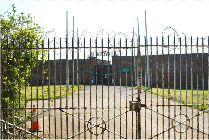
Fort Paull, closed in May 2022 © Angus Stephenson