Hail & Heritage - Walking Workshop Experience
02/04/2020 | Aaron Rogers
It was a pleasant enough morning when we set out the morning of March 7th, 10 intrepid adventurers keen to explore the south Devon coastline from Start Point to Torcross. The sun was shining, a coastal breeze was blowing, and spirits were high.
This lasted all of 5 minutes before, in typical British fashion the weather took a drastic change and started pelting us with hail. Luckily this didn’t last long, and our spirits remained high; we continued with our trek, and the weather soon cleared to be a sunny pleasant day. Though the weather would change again periodically, we got the worst of it out of the way at the start, and the whole walk was quite enjoyable.
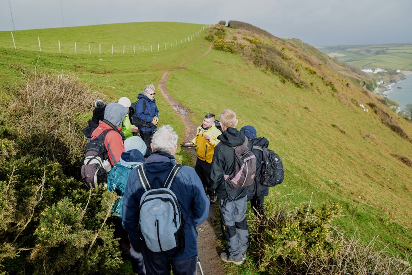
Our guide for the day was Grant Bettinson, Discovery Programme Officer for the South Devon Rivers. He took us through the history of the coastline, stopping at various points of interest that highlighted the theme of the walk, Lost Lives. Along the walk, participants were encouraged to add and update sites of archaeological potential on the CITiZAN app, with a quick onsite tutorial of how to do so. In this way, they found a further layer of engagement in their surroundings that they otherwise would not have had, causing them to think more critically about what it was they were seeing. Observations were made of things that might have otherwise gone overlooked by them, and it served the dual purpose of updating the official CITiZAN record.
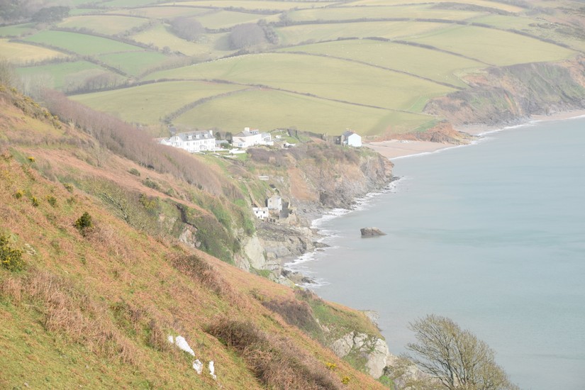
The first main stop along our journey was the now infamous site of Hallsands, a fishing village destroyed by coastal erosion. The coastline here is part of a closed tidal system where no new material is brought in by ocean currents. It was also the site of extensive commercial dredging where tonnes of material were removed, which triggered the erosive processes which destroyed the village. Here, human error and meddling in natural processes which at the time were poorly understood saw to the forced migration of the village’s populace.
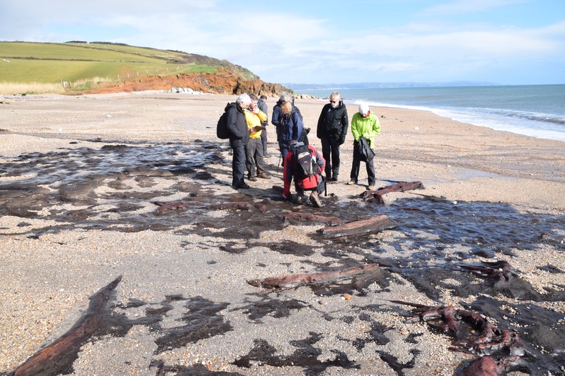
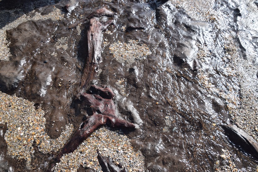
Another key stop was along the stretch of beach alongside Beesands, to examine the submerged forest there. The forest was unexpectedly exposed to a far greater extent than anticipated, allowing the participants to get a much clearer picture of the preserved wood and peat bed than they would normally be exposed to. The age of the forest is uncertain but is generally dated as Paleolithic to Bronze Age. The exposure of the forest here highlights the changing nature of the area, and how peoples use of the coastline has evolved over time. Where once it was a forest, now it is seaside cliffs covered in sheep pastures
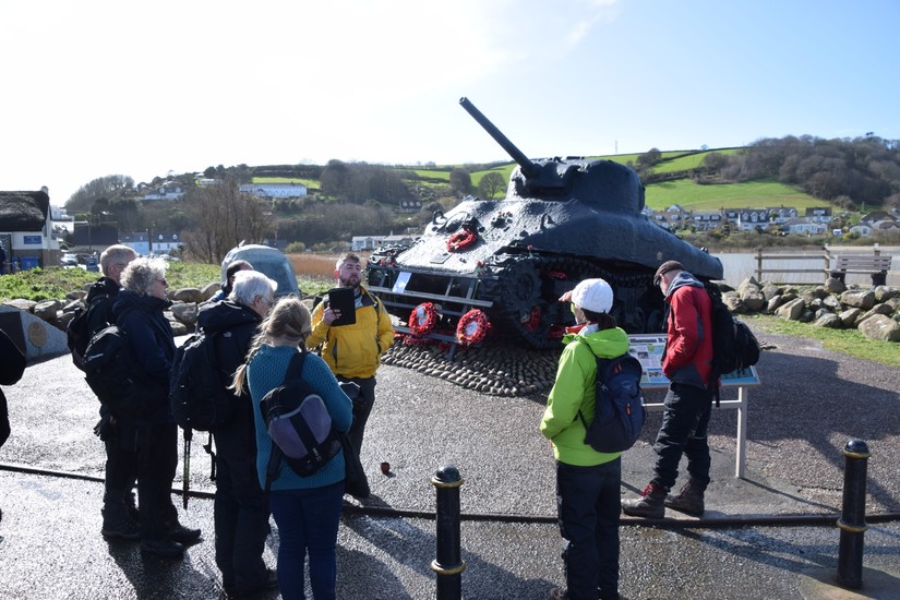
The final theme involved in our tour was the effect upon the landscape and the people who resided there caused by the Second World War. The South Devon coastline was heavily fortified with anti invasion entrenchments, including anti-tank fortifications, barbed wire blockades, earth trenches and embankments, and a host of pillboxes.
One of the most notable military exercises carried out in the south of Devon was Operation Tiger, a joint British and American military training exercise meant to prepare for D-Day. South Devon was chosen as a location for this exercise due to the geographical similarities between the coastlines here and those at Normandy. This exercise was disastrous and saw the deaths of over 700 American servicemen through a combination of German submarine action, friendly fire, and drowning caused by improper training in regard to their personal floatation devices
At the close of the walk, participants were asked what they thought of their experience. Feedback was unanimously positive, with several stating they intended to participate in future events. The use of the CITiZAN app provided them with a useful tool to learn more about the history of the areas they were exploring, as well as giving them the opportunity to engage with them in a more meaningful way in the recording and updating of features. This manner of community engagement has shown itself to be a successful medium in the engagement of public interest, and raising awareness of the fragile state of coastal heritage sites.