Wartime Defences at Auburn Sands
14/12/2018 | Chris Kolonko
Auburn Sands, East Yorkshire retains some of the best-preserved wartime coastal defences in the whole of Yorkshire. With both First and Second World War defensive structures surviving, it is an almost unique site where both era’s defences can still be recorded and interpreted.
The CITiZAN North team and our volunteers have spent a lot of time at Auburn recording the remaining defences and more importantly interpreting what survives. We have even recorded at least two previously un-recorded pillboxes and the remains of several First World War era pillboxes.
The First World War
Anti-invasion defences from the First World War have come to prominence in recent years. Research by Home Front Legacy 1914-18 and Martin Brown has revealed that coastal anti-invasion defences were much more common during the First World War than previously realised.
The East Coast of Britain was seen as vulnerable to small scale raids and a full-blown invasion prior to the outbreak of war. When war was declared extensive measures were taken to ensure the East coast was adequately defended, in case the German Army and Navy attempted an invasion.
An invasion fleet could set sail from ports in Northern Germany, or from the occupied ports of Belgium. This threat didn’t cease and invasion scares continued throughout the war up until the breaching of the Hindenburg line in 1918.
The coast of East Yorkshire remained vulnerable throughout the entirety of the First World War and was defended accordingly. There is some speculation as to whether this was a result of the coastal bombardment of Scarborough and Whitby in December 1914.
Auburn Sands’ First World War defences
There are at least two types of First World War era pillbox (with a possible third type recently identified) surviving in the area.
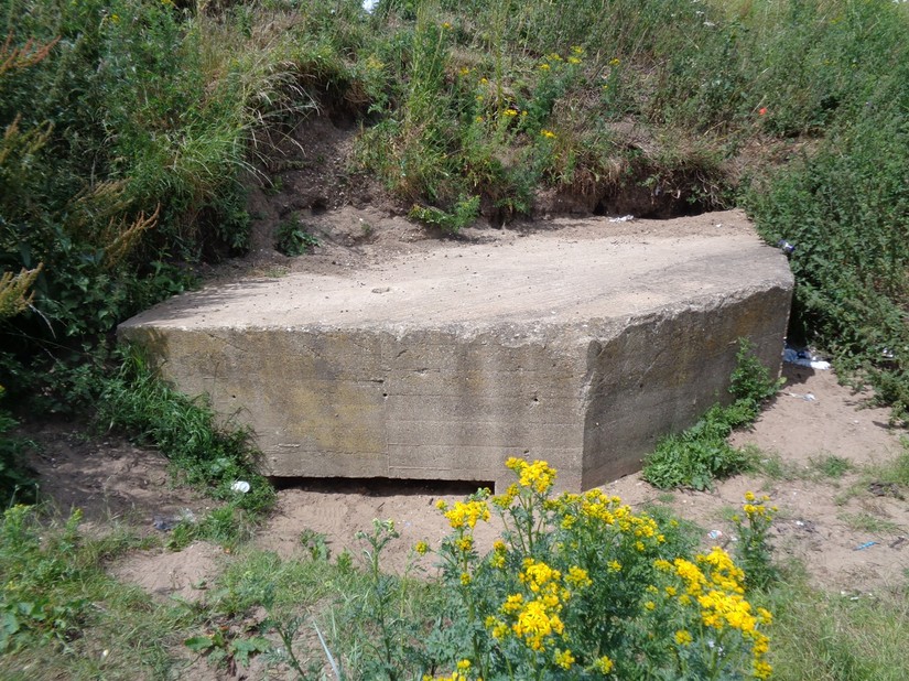
Five complete and at least one partially demolished example of a First World War pillbox survive at Auburn Sands, with the complete examples now being Grade II listed. A larger ‘blockhouse’ type pillbox can also be found close to Auburn Farm.
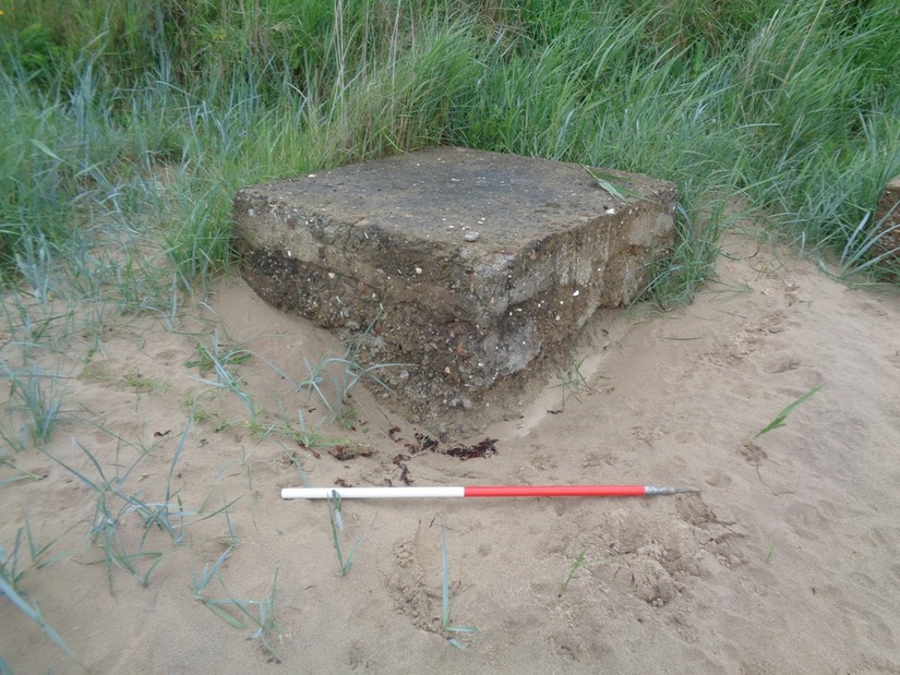
The First World War era pillboxes that survive at Auburn Sands are clustered around Auburn Farm, creating a strongpoint covering the beach exit to the East. The mainstay of the defences in this area was the small square infantry pillbox. This pillbox, known as the ‘square type’ for obvious reasons, features extremely thin reinforced concrete walls around 15cm thick. These wouldn’t be thick enough to withstand multiple impacts from bullets or shell splinters, so it is possible that the structure was meant to be sandbagged, or partially buried to increase protection.
The ‘square type’ pillbox that survives in front of Auburn Farm is particularly interesting. The pillbox originally had a single splayed loophole facing to the East. The listing information states this was for a machine gun, however, the arc of fire provided by the single loophole would have been very narrow. During the Second World War the pillbox was re-used and modified with additional loopholes cut into the structure’s front corners and the single rifle loophole significantly enlarged. This later modification reveals further clues about the construction of this pillbox.
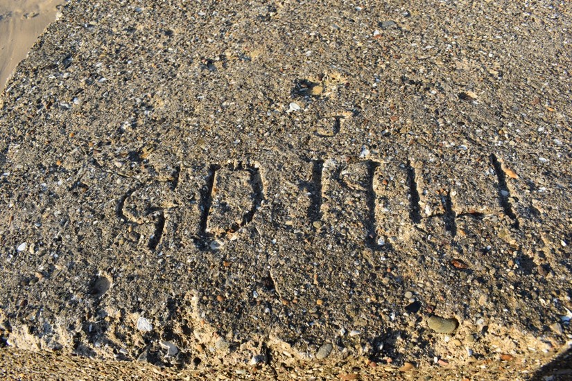
Marks in the pillbox’s concrete surface clearly show the imprints of the wooden ‘shuttering’ used to construct the pillbox. Shuttering is a wooden frame used to create a mould into which the concrete was poured. The later cut loopholes reveal the pillbox’s internal reinforcement, which consists of distinctive metal mesh; we’ve named it ‘diamond mesh’. This distinctive feature has allowed the team to identify the remains of further First World War era pillboxes on this stretch of coast that have long since been destroyed.
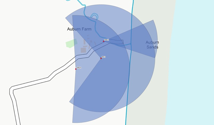
Mapping the arcs of fire (and effective ranges for the weapons used) for the First World War pillboxes allows us to gain an idea of how the pillboxes would have been used to defend the beach exit and Auburn Farm.
You can clearly see that each pillbox was sited to potentially cover other pillboxes in the area, as well as bring fire to bear on the surrounding open ground leading from the beach.
Please note that these mapped arcs do not take into account visiblity on the ground (I'm currently working on that). But they do represent the strategy behind the placement of the defences.
Auburn’s Second World War defences
The area’s Second World War concrete defences survive relatively intact and can still be interpreted effectively. The CITiZAN North team's investigation of these defences has revealed previously unrecorded defences and allowed us to build up a more detailed understanding of the Second World War era defensive landscape.
The defences in this area were constructed from May 1940 as part of the Coastal Crust defence network originally devised by Edmund ‘Tiny’ Ironside, Commander-in-Chief Home Forces from 25 May to 19 July 1940. Royal Engineers and civilian contractors would have worked extensive shifts to fortify this stretch of coast before the favourable invasion tides that would present themselves in September 1940.
The Auburn Sands defences were further modified throughout the war to incorporate new weapon systems and defence types, as well as to conform to changes in defensive doctrine.
Our investigation of the site has focussed on taking a closer look at how the Second World War era defences were sited within the landscape.
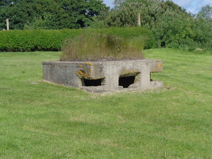
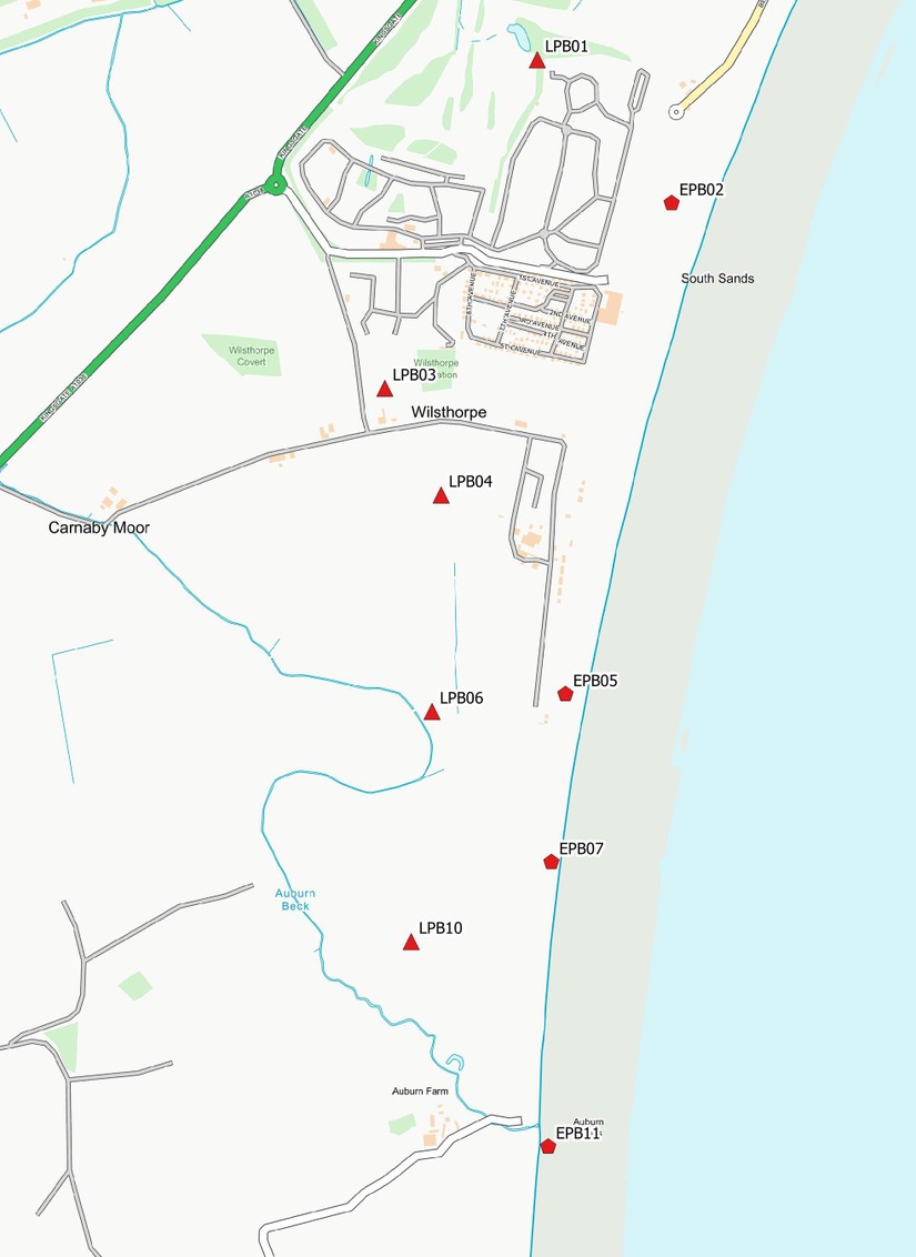
This investigation has revealed that the pillboxes at Auburn Sands have been very carefully planned and sited to provide ‘defence in depth’; with a forward line of ‘Eared’ machine gun pillboxes covering the beach front and a secondary line of ‘lozenge’ infantry pillboxes covering a ridge of high ground to the rear of the beach.
Interspersed between the beach front pillboxes were further weapon pits (small trenches for 2-3 soldiers) and section trenches (trenches to accommodate around 8 soldiers). Closer investigation has revealed several of these previously unrecorded positions.
Two rather unique designs of pillbox were employed on the Yorkshire coast.
The first is this machine gun pillbox.
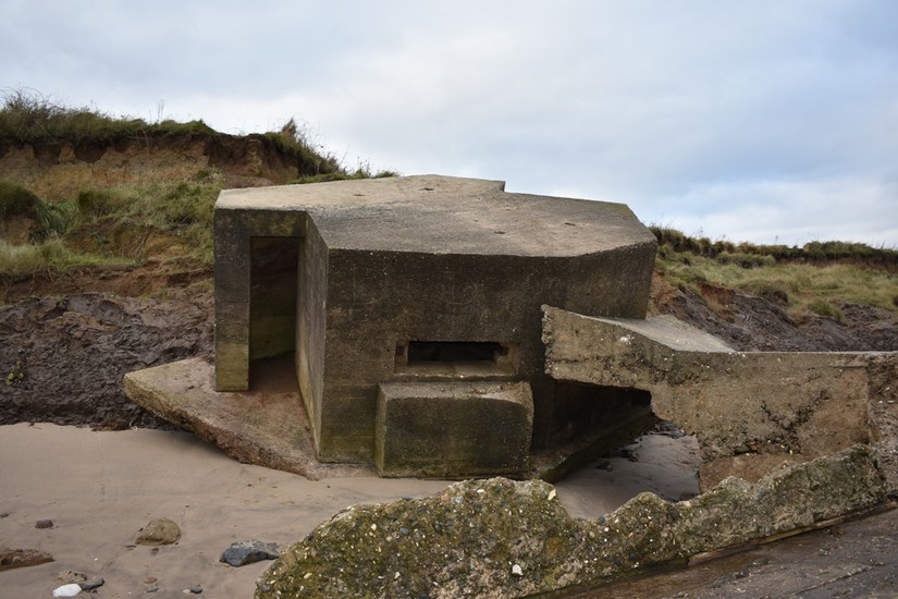
This localised irregular hexagon design, sometimes referred to as a ‘Eared’ pillbox, is a design only found in Yorkshire. This pillbox could house two Vickers Machine Guns firing out of the large loopholes in the structure's oblique faces. This pillbox was specifically designed to allow the machine guns to fire in enfilade to the pillbox’s flanks; allowing the guns to cover a wider area with effective fire.
This pillbox gets its nickname from the two forward projecting entrances that are said to resemble a pair of ears (I personally have never seen the resemblance!). Interestingly, these entrances face directly towards the expected avenue of approach the enemy would have taken, meaning that if the pillbox came under fire the soldiers inside would have been unable to vacate the pillbox. Whether this is a case of bad design, or a deliberate attempt to keep the occupants within the position is unclear. However, it is quite possible that the pillbox was originally intended to be incorporated into a trench or sandbagged breastwork to protect the entrance. Protective brickwork can be seen in postcard images of 'Eared' pillboxes emplaced to defend Scarborough to the North. Operational orders from nearby Filey Bay show that the forward Battalion occupying the forward defences would be under orders to not retreat under any circumstances and await reinforcement. So maybe the forward facing entrances were a means of ensuring the Vickers Machine Gun crews continued to operate the guns while under fire!
The Auburn 'Eared' pillboxes feature a modification in the form of an additional recess hacked into the area below the loophole. This feature has not been recorded before. It is possible that this in field modification was carried out to allow the muzzle of the tripod mounted Vickers guns to protrude further from the loophole; creating a wider arc of fire.
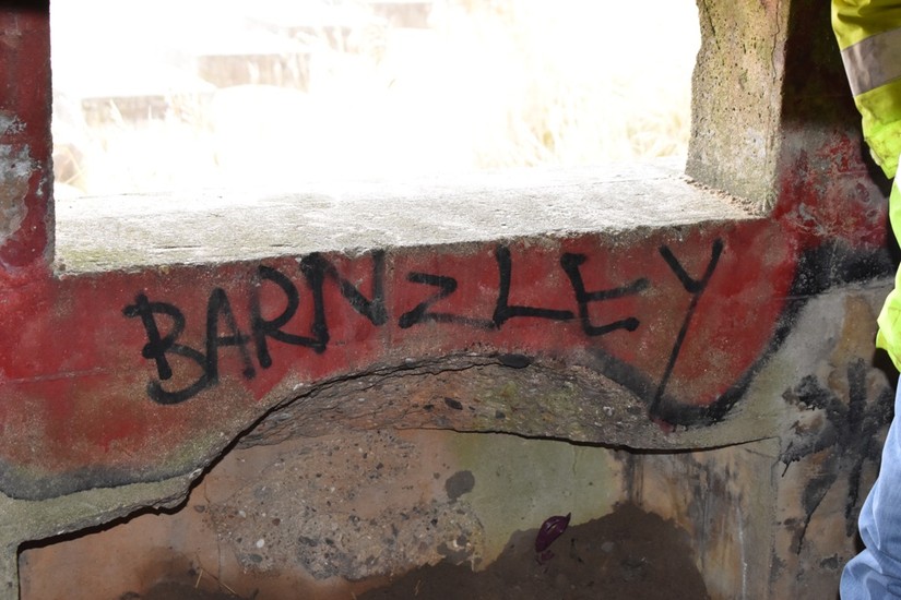
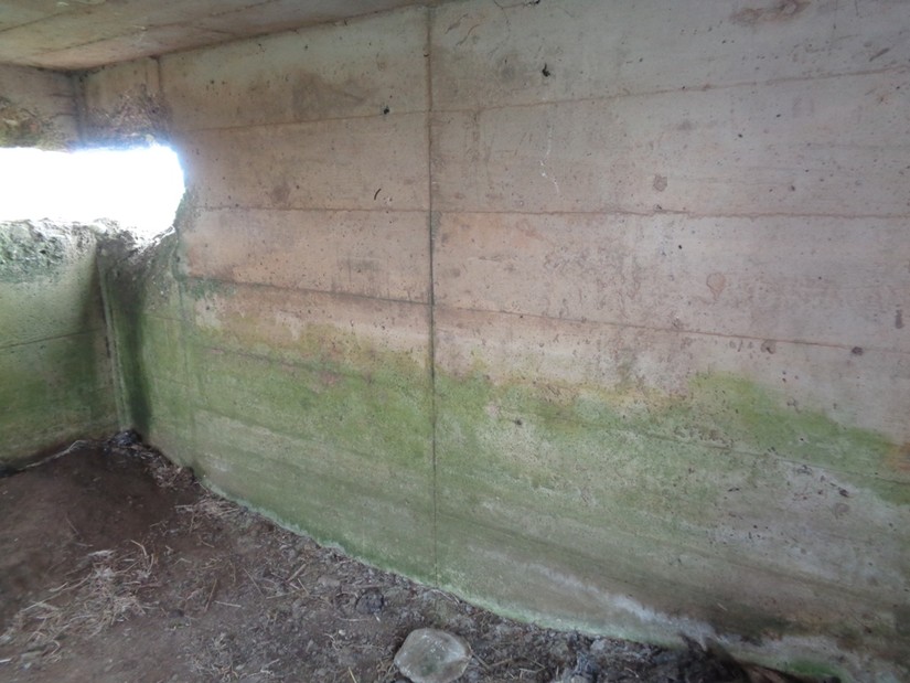
Several of the 'Eared' pillboxes also retain a range diagram above the loopholes. These simple diagrams show the occupants within the pillbox the range to certain landmarks; allowing them to accurately adjust the range of their fire. One of which specifically mentions firing on fixed lines; a method of firing a machine gun that relies on the use of a tripod. Unfortunately these rare range markings have succumb to graffiti. However, recording these features through CITiZAN will enable the information to be preserved for future generations.

The ’Lozenge’ pillbox is another localised design of infantry pillbox commonly found in Yorkshire.
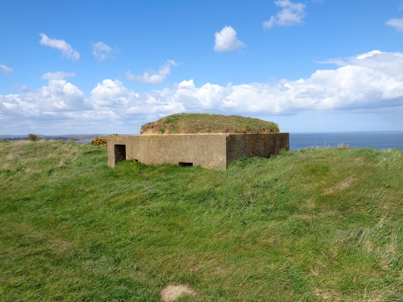
This simple sub-hexagonal pillbox was capable of housing up to eight infantry (a section), allowing them to fire both their rifles and Bren Light Machine Guns from the confines of the pillbox. It was quickly realised that any infantry caught inside a pillbox that comes under fire are essentially trapped- a pillbox’s single entrance would make it extremely difficult to leave the structure while under fire. Pillboxes also significantly limit the occupying infantry’s field of view, essentially making them blind to any concealed enemy movement. In combat only the Bren gun team of the rifle section would occupy pillboxes. The rest of the section would take up surrounding positions, namely trenches and weapon pits, to augment the Bren gun team’s fire, protect the pillbox and observe enemy movement.
Both of the pillboxes encountered at Auburn Sands feature reinforced concrete walls approximately 40cm thick. This was considered to be of 'bullet proof standard' by the military at the time. How these pillboxes would have fared against concentrated artillery fire is open to debate.
The Forward Defences
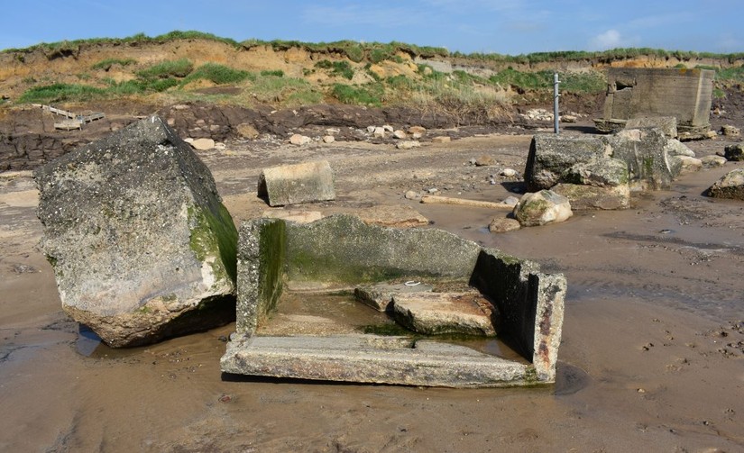
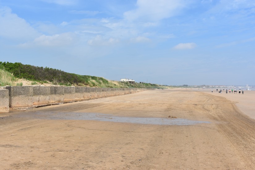
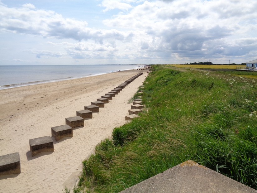
An extensive anti-tank wall, lines of anti-tank blocks and ‘Eared’ pillboxes line the base of the boulder clay cliff. This line of defences was specifically sited to take full advantage of the wide-open expanse of the beach, with ‘Eared’ pillboxes sited to pour withering fire down the length of the beach in both directions. The pillbox’s arcs of fire also interlock, which would have created a deadly crossfire on the beach. The ‘Eared’ pillboxes are also able to cover the adjacent anti-tank obstacles with considerable fire, making it difficult for enemy soldiers to destroy and clear these obstacles to allow vehicles to leave the beach. The pillboxes in the forward defence line are also sited to defend the viable beach exits which could have been used by infantry and vehicles to leave the beach and push inland.
A substantial double row of anti-tank blocks are sited above the high-water line, as well as at right-angles to the beach to restrict vehicular movement towards the beach exits.
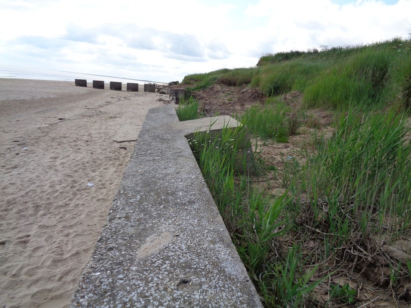
Two clear phases of defence construction are also represented within the surviving beachfront defences.
The earlier anti-tank defences, including sections of the anti-tank wall and anti-tank blocks, are constructed from an extremely sandy concrete mix which hasn’t withstood the test of time quite so well. A second row of anti-tank blocks constructed in front of the earlier defences is constructed from a more uniform and robust concrete mix; consisting of coarse pebble aggregate with substantial angle iron reinforcing the corners.
Further evidence for a second phase of construction is provided by graffiti in two of the anti-tank blocks which clearly dates the construction phase to 1941. Dobinson (1996) states that new reinforced concrete anti-tank cubes were constructed on this stretch of coast in February 1941.
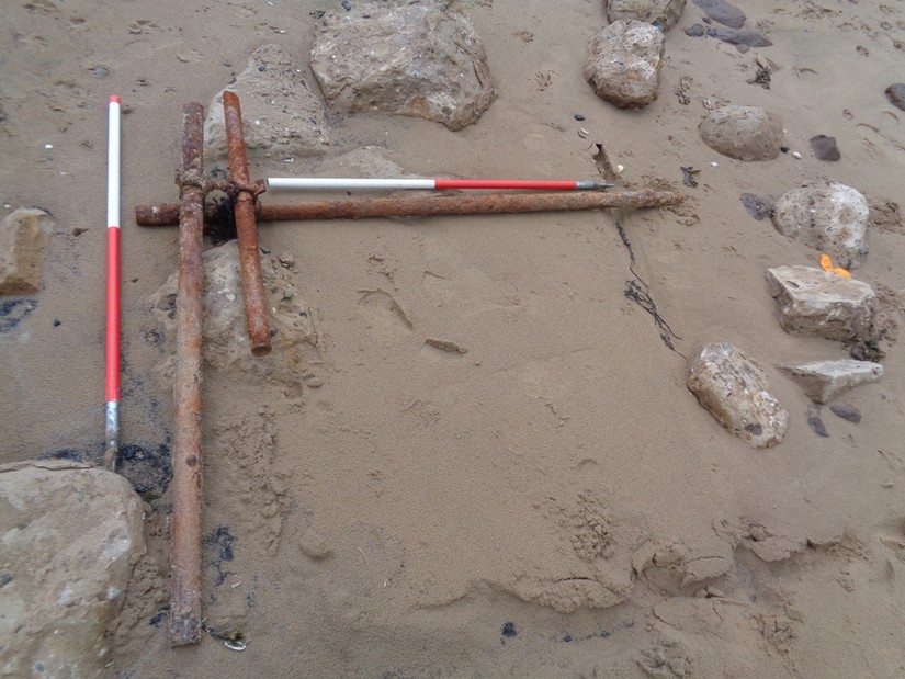
Other rarely encountered wartime features have appeared on the beach during the team's site investigations; including screw pickets for barbed wire and remains of Z1 anti-tank scaffolding. Z1 scaffolding was erected en masse in this area from May 1941 according to Dobinson (1996). Often this scaffolding was removed and recycled after the war, however in this case it may have been hastily buried on the beach or not completely removed. These rare features have been recorded through CITiZAN. Z1 Scaffolding would have looked something like this.
Our work at Auburn has also highlighted several surviving trenches in the area. Trenches were integral to the Second World War defensive landscape. The trench was quick and cheap to construct and afforded better concealment and protection to attack than a pillbox. Simple trenches would often outnumber pillboxes in a defended locality but today few surviving examples have been recorded.
One example survives in good condition, with the parapet (forward protective bank) and parados (rear protective bank) clearly distinguishable. The size of the trench suggests it could accommodate a section of infantry, allowing them to fire in a 360-degree arc, primary focussing upon the beach and inland approaches.
Second Line of Defence
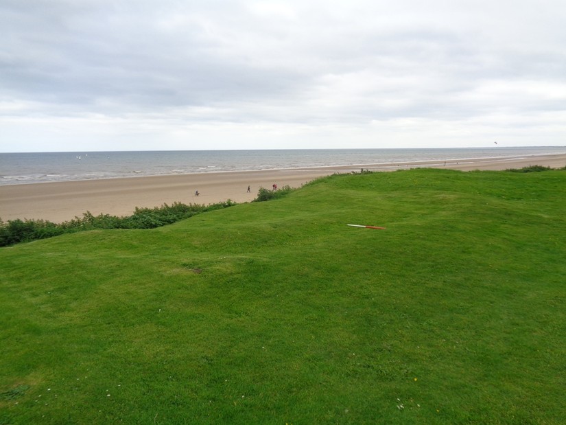
The second line of defence focusses upon a slight ridge of high ground that runs from North to South approximately 300 metres behind the beach front defences.

This secondary line had three functions. The first was to protect the rear of the beach front defences from an attack coming from inland; possibly by Paratroopers dropped to secure objectives inland. Secondly, to act as a buffer to halt enemy soldiers that breached the beach front defences. Thirdly, these defences covered the open fields surrounding Auburn Farm which could have provided a landing ground for gliders and transport aircraft.
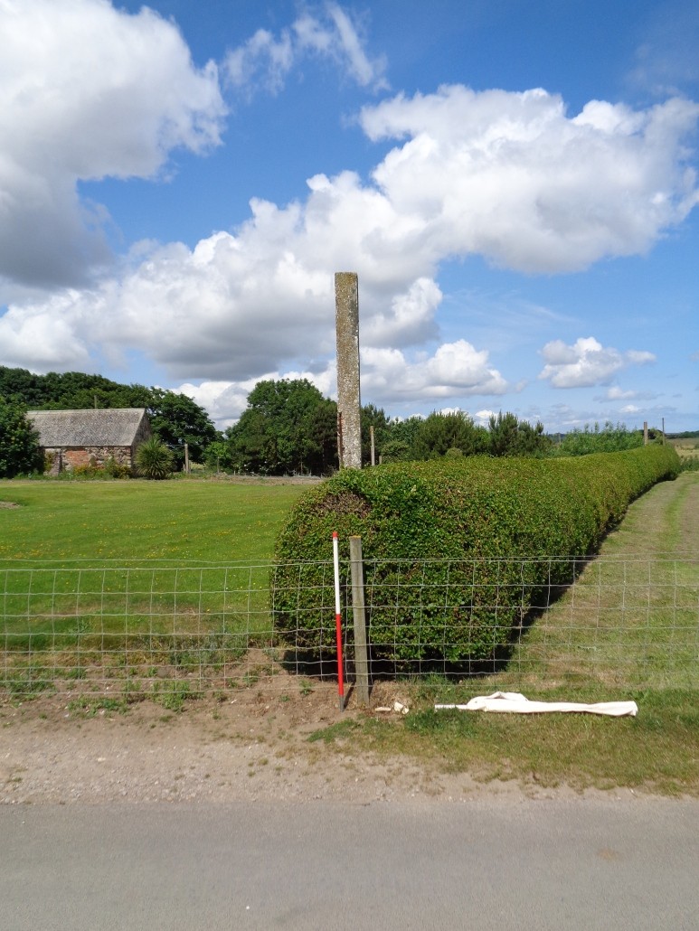
One surprising survival are the large numbers of anti-landing poles that surround Auburn Farm. These were first identified in the area through the Rapid Coastal Zone Assessment of the area. Since then the CITiZAN have found considerable numbers of them re-used as fence posts. These concrete poles would originally have been sited within the field boundaries to disrupt aircraft and gliders attempting to land or take off. Most of these poles have been used as fence posts, however one example still survives at full height. Aerial photographs of this area also show that anti-landing trenches were dug within fields which were perceived as vulnerable to landing transport aircraft or gliders. These trenches would have been infilled towards the end of the war to provide further land for farming. None of these trenches survive.
Auburn Farm itself was used as a Company headquarters according to the War Diary of the King’s Royal Regiment. This unit acted as the forward Battalion defending Filey Bay, to the North, from 19 April 1941 to 23 May 1941.
Given their proximity to a major beach exit the First World War defences would have been pressed back into service, protecting the Company Headquarters in Auburn Farm and also acting as a defended locality; essentially a defended strongpoint with all-round defence. The previously mentioned modification to the square pillbox clearly shows this later re-use and modification.
Interpretation
Plotting representative arcs out to a range of 1000 yards (well within the effective range of the Vickers Machine Gun) for the beach front 'Eared' pillboxes gives us an idea of the area which they could cover with effective fire. The wide expanse of beach provides great visibility across much of the bay, allowing the gunners within the pillboxes to pour fire into any infantry landing on the beach. The arcs clearly illustrate the interlocking nature of the fields of fire, with each 'Eared' pillbox being able to cover the front of the adjacent positions as well as the anti-tank obstacles.
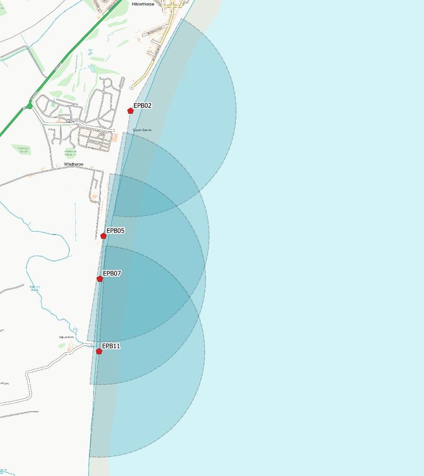
One thing that does become apparent from the plotted arcs of fire is the gap in the line of 'Eared' pillboxes around Wilsthorpe. The distribution of the pillboxes shows they are almost evenly spaced along the beach front, with the arcs of fire indicating that the pillbox to the North would have been rather isolated from the adjacent pillboxes. This suggests that one or two of the beach front pillboxes have been demolished, destroyed or buried. The location of one of the lost pillboxes was confirmed by a local resident who remembers a pillbox being buried to make way for a new beach access road. The location of this pillbox had been predicted pretty accurately using the method of mapping arcs of fire.
When we plot the arcs of fire for the second line defences we can clearly see how well they were placed within the landscape. Although this interpretation does not show us the viewsheds of these positions (the areas which can be seen from a set location) we can still gain a sense of why these pillboxes were sited at these specific locations.
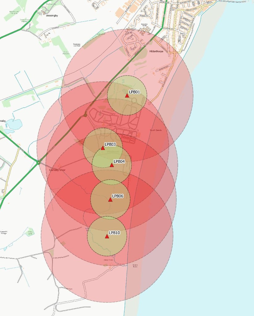
The red circles indicate the maximum effective range of the Bren Light Machine Gun, while the smaller green circles indicate the effective range of the Lee Enfield rifle (in this case the maximum range at which a soldier with a rifle can expect to fire at, and hit a human sized target).
The locations of these pillboxes provide relatively clear arcs of fire over 360-degrees. However, it is worth pointing out that even though this line of pillboxes would not have been able to fire onto the beach itself (as indicated by the mapped arcs), from these locations the soldiers within the Lozenge pillboxes could effectively cover the beach exits that lead inland with effective, interlocking fire.
Conclusion
As we've seen, the coastal environment can still reveal evidence of the First and Second World Wars.
Hopefully this case study gives you an idea how much more there is to learn about our surviving wartime coastal defences. Through the work of the team and our volunteers we have been able to better understand and appreciate the surviving wartime defences in and around Auburn Sands, as well as record our findings for future generations through CITiZAN.
Sources
Dobinson, C. 1996. Twentieth Century Fortifications in England 2: Anti-Invasion Defences of WWII. Council for British Archaeology/English Heritage. Unpublished report.
6th Battalion King's Own Royal Regiment War Diary WO 166/4394
Brigham, T, Buglass, J. and George, R 2008. Rapid Coastal Zone Assessment. Yorkshire and Lincolnshire. Bempton to Donna Nook. EH Report No. 235. Kingston-upon-Hull: Humber Archaeology