Defending our Isle: The military defenses at Bridlington
24/03/2016 | Megan Clement
It’s June 1940, Operation Dynamo, the evacuation of Dunkirk has just happen and British, French and Belgium troops have withdrawn from France. The same summer the Battle of Britain began; if the Luftwaffe had win, there is a serious threat of an invasion of mainland Britain on the horizon. After Dunkirk, the Home Guard Command started to prepare in case of an invasion did occur and began heavily defend the south coast. Soon after, Scandinavia and Low Countries fell under German occupation, and the threat of invasion now applied to the whole of the East Coast of Britain.
After the south coast, both East Anglia and the Yorkshire Coastline were identified as vulnerable to invasion. Bridlington Bay, was and ideal location for an invasion; flat sandy beaches for amphibious landing crafts, above the foreshore flat landscapes perfect for tanks and gliders to land, an isolated small population with only the residence of Bridlington close by and finally the control of an established port at Bridlington, once it was under German control. According to the Defence of Britain Survey undertaken in the Late 90’s, Northern Command had some of the best defend beaches in the country, this includes Bridlington.
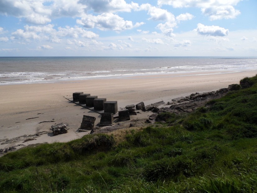
The evidence of defending our isle is still present across areas of the UK; pillboxes, anti-tanks cubes and barbed wire entanglements. In the inter-tidal zone beach scaffolding was established, this was to make it harder for landing crafts to get up onto the foreshore. Much of the beach scaffolding, like the beaches closest to Bridlington, were removed in 1944-45, to allow it to return to its previous use as a pleasure beach for holiday makers. Barbed wire entanglements would have covered the areas where beach scaffolding was not. But to the south of Bridlington the remains of this military landscape still exists.
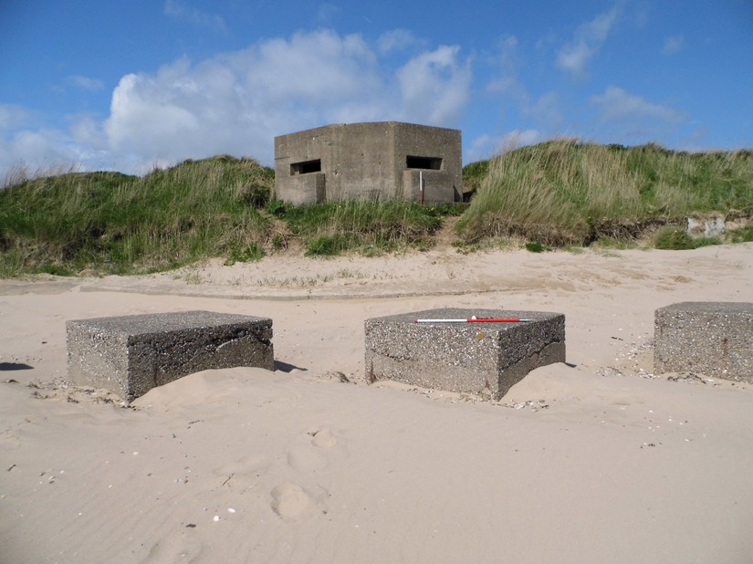
Along the beach are several eared pillboxes, which are unique to the Yorkshire coastline. Eared pillboxes, are called such, because they were built for the use Vickers machine guns. Inside there is a groove to stand the tripod for the machine gun, but this groove in the concrete made this part of the pillbox vulnerable. An extra block of concrete was places on the front to reduce this vulnerability and leading to the name “eared” pillbox.
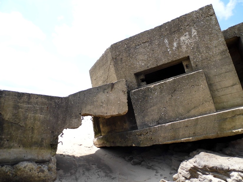
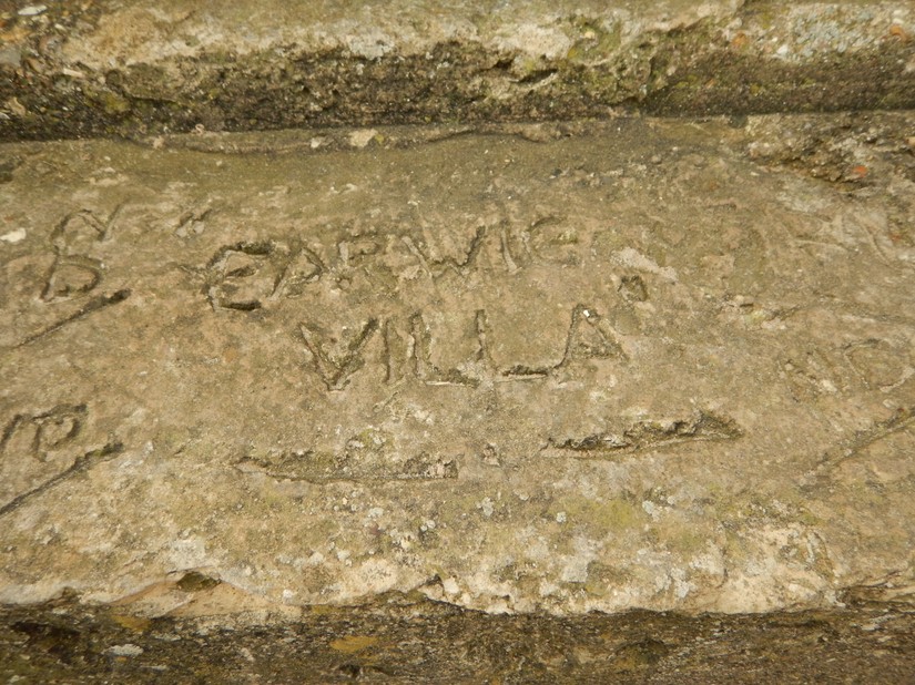
The entrances to the pillbox are interesting as they face the front not the back, and is unusual because if the beach was under attack, the solider within the pillbox needed to retreat, but to leave the pillbox they would be required to come out into enemy fire rather than away. This may suggest that these pillboxes were “Do or Die” positions. On one of the pillboxes is inscribed the phrase “Earwig Villa”, which was done whilst the concrete of the pillbox was still wet.
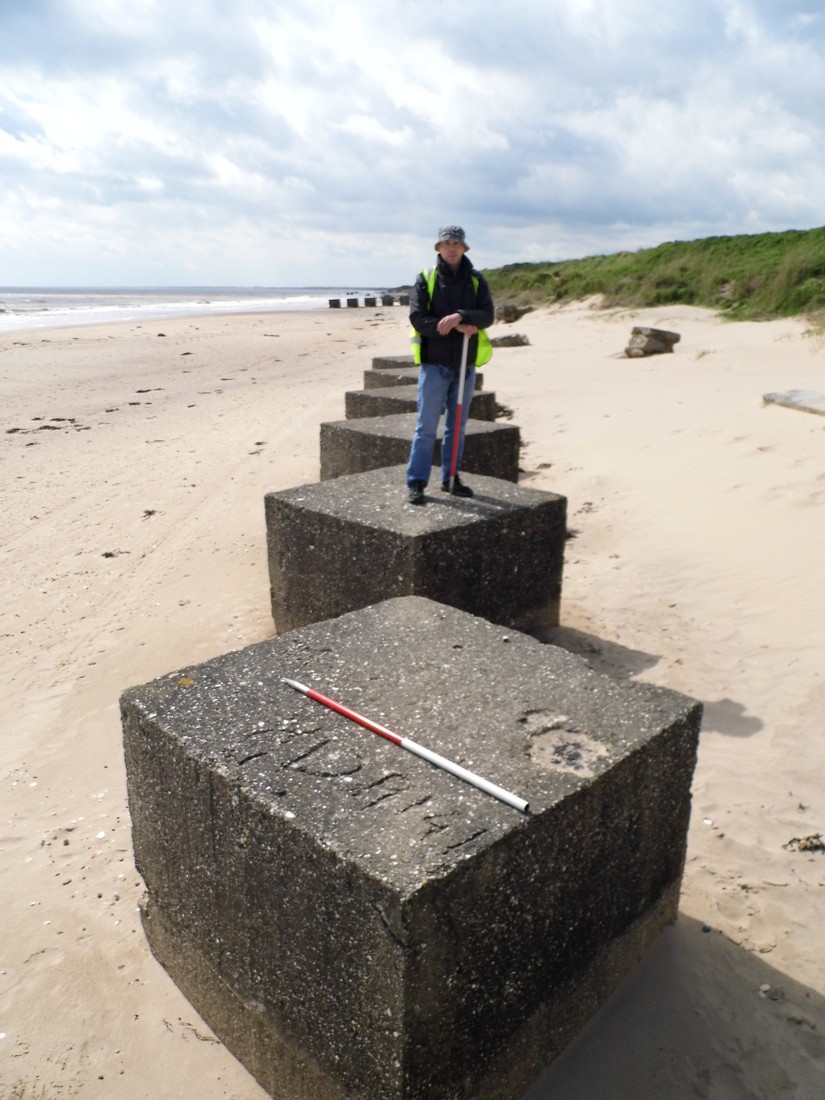
Anti-tank blocks line the foreshore here; with deep foundation they are meant to be so immovable that tanks cannot go through them and rather have to go over them, exposing the weakly armour undersides of the tanks, which can then be fired at. The anti-tank blocks are arranged in batches of both parallel and perpendicular to the sea, which helps to divide up the beach and channel enemies towards the pillboxes and into fire.
More war time graffiti can be found on the anti-tank blocks along the foreshore. Three of them have initials, engraved when the concrete was still wet; one has the initials MDP and two have GD 1941. The date gives us an indication as to when some of these defences were put in place. This was towards the end of the push from Home Guard Command to defend the coast.
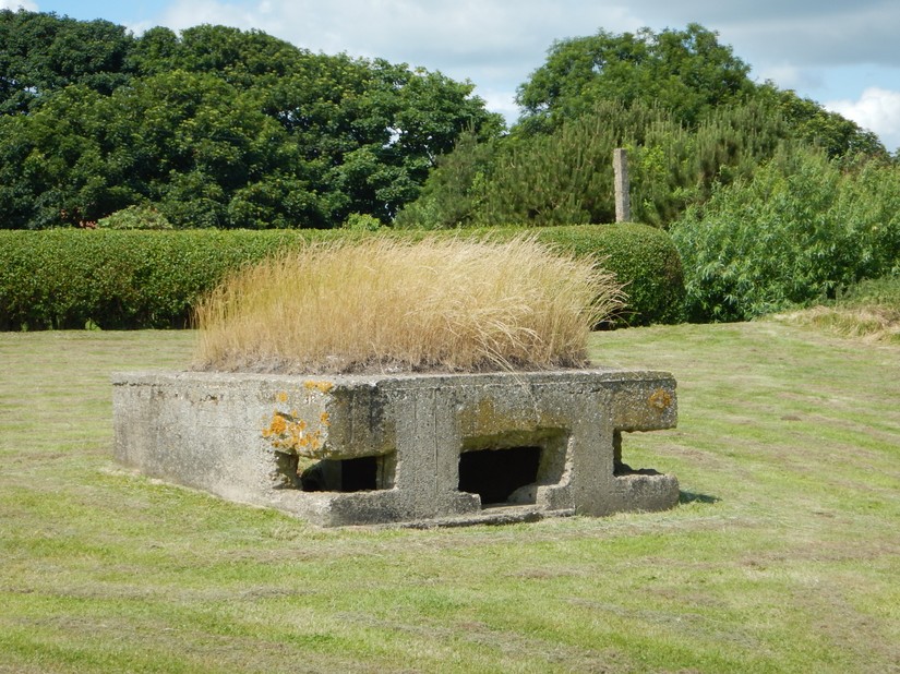
In the fields behind the foreshore, the military landscape continues. With and a number of First World War pillboxes. At least one has been reused in World War Two, with the embrasures at the front were added or enlarged to increase the field of visions, possibly for machine guns. The pillbox’s position here is likely due to the bridge and forms the second crust of defences to prevent easy access for the enemy if they get up off the beach. Around the corner is the partner of the pillbox, assisting in protection of the bridge. Also present are a large number of anti-glider post, many of these were taken down after the war and for some reason these remain. These would prevent enemy aircrafts from landing and dropping troops behind the original defensive line.
This area however has an older history with a suggesting 7000 years of human occupation: including the discovery of polished stone axes heads from farmlands and Roman pottery found eroding out of sands dunes. Aerial photographs show Iron Age and Roman enclosure, field boundaries and ditches. The biggest double ditch enclosure is 44m in diameter and contains a circular feature 12m in diameter which is like a hut circle.
There are also three Deserted Medieval Villages along the coastline here; Hildersthorpe, Wilsthorpe and Auburn. Both Hildersthorpe and Wilsthorpe were mentioned in the Doomsday Book of 1086, their names indicating they were probably both originally Scandinavian settlements. 60% of the population died during the Black Death and the villages started to decline, with only 40 residents between the two villages in the Late 19th century. Hildersthorpes is now part of the golf course. The centre of Wilsthorpe is yet to be found by the south and west edges have been identified. Part of the DMV of Auburn has eroded into the sea. Ridge and furrows are still present and also visible is the remains of St Nicholas’ Chapel, which was the Chapel for Auburn and was demolished in c.1731. It was excavated in pre-1928 and again in 1948.
The east coast of Yorkshire can erode up to 7m in a year, and as a result much of this archaeology on the Bridlington foreshore is at risk of being lost. The pillboxes, anti-tank blocks and defences are perhaps most at risk, despite being less than 100 years old. Several guided walks and a training session will be undertaken in 2016 to help record some of these at risk features.
