The excavations of Tennyson Down - following one of CITiZAN's archaeologists
01/08/2016 | Alex B
Day 1
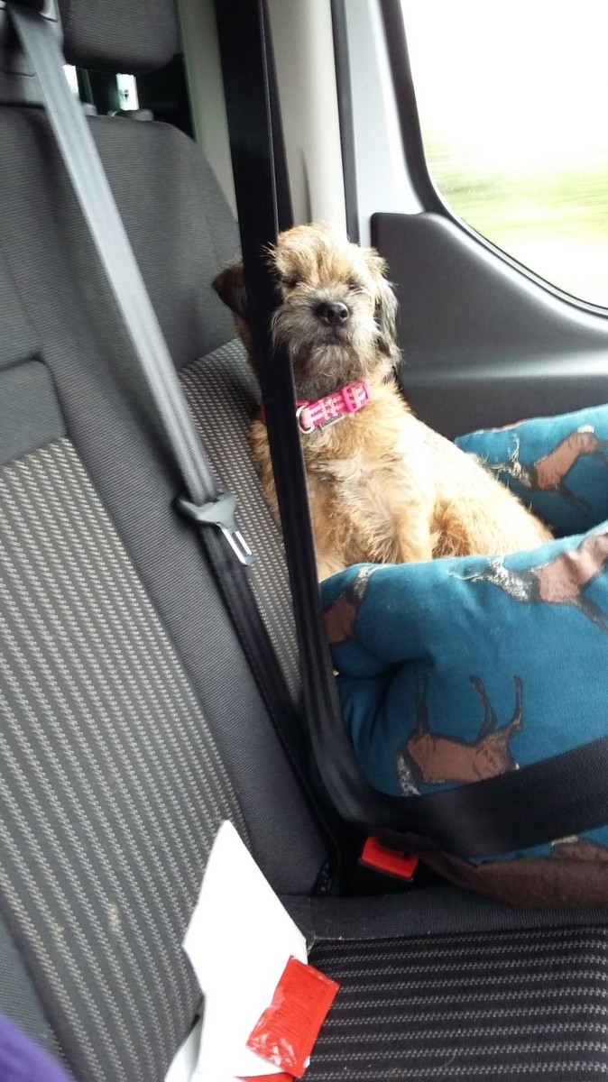
Starting at 0600 it is a early start on the way down to the Isle of Wight, however it is not too bad a drive through the New Forest down to Lymington to catch the ferry to Yarmouth. I am also not lacking company today, the CITiZAN dog AKA Aggie has come along for the ride – though I must say, she didn’t look too impressed about the scenery on the way down!
My first time up to Tennyson Down, what luck – in glorious sunshine!
In archaeology when ground is broken, we often ensure that this is watched to make sure that no archaeology is disturbed during that initial mechanical excavation. This was mine and Aggie’s job for the day.
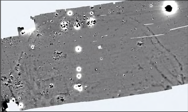
Underneath you can see an image of the geophysics plot, this is an image of the processed data that was gathered by MOLA Northampton and the National trust volunteers in May. You can see a semi-circular shaped black anomaly which has been interpreted as a ditch. With the geophysics plot in hand it was time to start the removal or the turf and top soil of the trenches we were going to excavate over the next week.
©MOLA
Initially the brief had specified that the turf on Tennyson Down was to be cut with a turf stripper. This would ensure that the turf could be re-laid quickly with relatively little impact on the turf – this would satisfy both the National Trust and Natural England as the area is a Site of Special Scientific Interest (SSSI). However things didn’t go to plan and the turf was so knitted together that the turf stripper couldnt splilt the turf, not even managing to make an impact. So we had to use the digger to very carefully strip the turf.
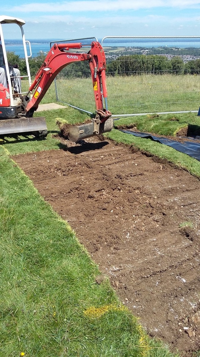
Using the digger to peel away the turf from the Trench 1
I must say it was fairly hard to concentrate on looking at the ground when we have such a beautiful view as this!

Day 2
Volunteers arrive!
Another early start for me but no where near as bad as the chaps who came down from MOLA head office in London – grumblings of a 4am start were heard of and I felt my 6am start was, in actual fact, fairly reasonable!
We started the day by picking up 15 eager volunteers from a car park on the opposite side of Freshwater Bay. Getting onto the Down we discovered that the CITiZAN van can do ‘offroading’ – and it can do it well! Fully laden it made it to the top, not sure if it rains in the week we will be so lucky!
With a slightly slow start which is always accompanied with the start of an excavation, five volunteers went to each trench.
Trench 1
Located closest to the Tennyson monument, Trench 1 was placed over a geophysical anomaly. They started off mattocking away material (after a Health and Safety talk regarding the appropriate use of mattocks, shovels and trowels of course), we uncovered a small round feature which had the shape and form of a post hole but relinquished no artefacts which could be used to date the feature. It looked like a positive beginning to Trench 1!
Trench 2
Located to the north east of the monument, trench 2 measured 10m SSE/NNW and 2m in width, the trench was placed over a geophysical anomaly which is considered to be the outer ditch of the enclosure. The trench also straddled the most complete sections of Bank, it was hoped we could build up a picture of the construction of the bank and ditch through looking at the profile. Proving the geophysics correct we found the ditch and started to excavate the fill in the hope that we would find lots of artefacts to help us understand the enclosure.
Trench 3
Located 150m away from Tennyson monument, trench 3 was 12m in length and 2m in width on a SSE/NNW orientation and was placed over a geophysical anomaly which was considered to be a possible pit feature which may be associated with the construction of the ditch. We left day 2 with a possible irregular shaped pit emerging from the subsoil.
With temperatures rising to over 26 degrees working was very tough, regular water and sun screen breaks were required which allowed the many passers by an opportunity to have a chat with the volunteers regarding the work that they have done.
We also had a visit from Simon from IoW radio who had done some promotion for asking for volunteers for us come up to do a first day dig piece on the local radio.
Day 3
More of a misty start to the day! Getting on to the down was like heading into the clouds – when driving a vehicle up there you suddenly become very aware of the unfenced cliff edge 100m or so on the other side of Tennyson monument.
The day started with a conversation with CITiZAN, MOLA and the National Trust to discuss whether we needed to put in a fourth trench. It became fairly obvious to us on the first day of excavation that the buckets of artefacts we were hoping for to help us identify what this enclosure was used for and the date were not appearing. We decided to hold out one more day to see if there were any significant developments in the trenches which were already open….
Trench 1
The half sectioning of the trench continues and by the end of the day the decision had been made to close this trench, which natural chalk definitely hit and no more features identified or recorded it was planned one last time by our volunteers and subsequently closed.
Trench 2
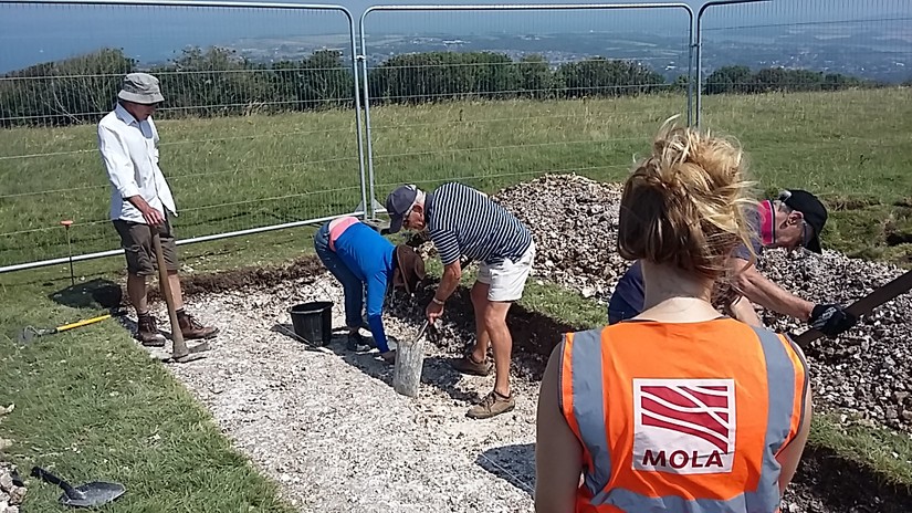
We started the day by carefully investigating the fill of the ditch. During this time a singular copper/bronze object was identified, c.5cm in length and tapered at one end and on one side, the object has been taken back to MOLA for XRay and subsequent assessment to determine the use and age of the object.
Trench 3
We continue to half section trench 3 cleaning it back as we go to ensure that nothing is missed. The irregular feature has turned into a pit with the sediment feeling much looser – no artefacts but a lot of very white chalk!
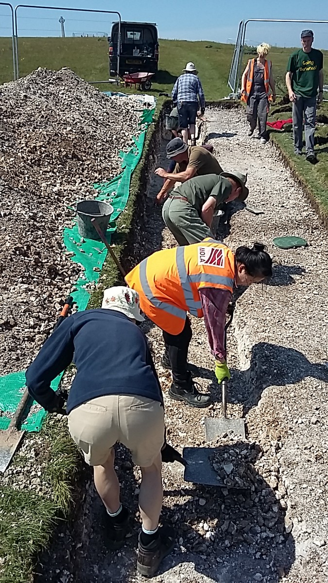
By the end of the day we had come to the decision that we needed to open a further trench about 30m to the south of Trench 3. When looking at the geophysics the ditch on the eastern side of the enclosure appeared to be flanked by an inner ditch, smaller in size that the larger outer ditch. It was considered that this possible double ditch needed to be investigated to understand the nature and also the possible date of the enclosure.
Day 4
A new round of volunteers ready for the next two day stint arrived at the car park waiting to be picked up, as well as some faces from Tuesday and Wednesday! A slightly quicker start for this lot of volunteers after the relevant forms had been filled in we sent them off to Trench 1 and 3 to continue excavating the ditch and bank.
After a panicked call to the landscapersb last night who had initially stripped the turf we managed to get them onsite this morning which was a huge relief as there had been some mutterings about hand turf stripping. The digger hand enough trouble removing the turf - I dread to think how long it would have taken to remove 60m2 . WSeeing the turf being removed I was really encouraged to see a texbook ditch and bank profile being revealed.
Thursday evening for me was getting prepared for the evening talk to the community tomorrow night – after dropping the volunteers back to the pick up point it was off to the hotel to try and make a suitable presentation about the project which would be interesting enough to hold everyone’s interest for an hour!
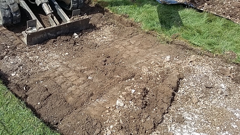
Trench 2
The volunteers were still working there way through the profile of the bank and ditch during the morning but by the afternoon they ad progressed to recording the profile.
Trench 3
The large pit gets bigger!
Trench 4
The cleaning back of the new trench started with a few of the volunteers, it was important to define exactly where the ditches and banks of the trench were before excavating them. With the main ditch this was fairly easy, however with the smaller inner ditch its irregular form proved for difficult interpretation and it was downgraded from ditch status to a gully!
Day 5
We start with the guided tours of the excavation today, rather quiet on this front!
The volunteers continued to work excavate the trenches with Trench 2 being final recorded today by all of our wonderful volunteers!
That evening, I had arranged to give a talk to the local community. In the small community that is Freshwater Bay and Totland, the project felt it was important to try and reach out to the local community to relay what had been found of the down. At the time of the organisation of this, we had hoped for lots of artefacts and at this point we had hoped to be able to tell a date and therefore be able to discuss the enclosure with comparisons of its contemporaries. Unfortunately due to the lack of dateable artefacts this was not possible so a presentation of two halves was developed. Gary Marshall from the National Trust (archaeologist for the south east) first began by speaking about the role of the National Trust on the Island and the local archaeology. Then it was my turn, to present the results of the excavations. Rather than attempt (and probably fail) to favour one interpretation over another I presented three possible interpretations a Neolithic Causewayed enclosure, a Bronze Age Circular Enclosure or an Iron Age promontory fort. It was a good talk with excellent engagement from those who attended. Tea and cake was provided by the lovely Dimbola lodge in Freshwater Bay and speaking as a cake connoisseur – it was very good!
Day 6
A new selection of volunteers today for the final couple of days, we were filled with hope as everyone who has seen any archaeology programme knows that that final day of excavation is when the best artefacts are found. Unfortunately we were not so lucky, we ended the day with a few more waste flakes to add to our pile.
The weekend was more about the public outreach and participation. With family activities planned as well as guided tours of the excavation CITiZAN and the National Trust made a space. As we had been working on public engagement for this project myself and Gary from the National Trust set up a stall to provide information on what we were looking for and some family activities for the children to get involved in. We had everything from pot making, to Mesolithic fish trap making, find a ship in the submerged sand, find the submerged artefacts and piece a pot together! It was great fun and even I had a go at making a coil pot – it isn’t going to hold anything substantial but I made it! Unfortunately the weather did not co-operate, despite the glorious sunshine we had been having for the past week the clouds descended for the most part of the day.
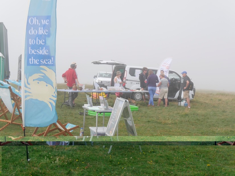
© National Trust
For those working on the excavation, today was largely about getting any final bits and pieces cleaned before the final recording and planning which would take place tomorrow.
Day 7
Last day on site! We continue with the recording of all the features we have identified in the three remaining open trenches. All of our volunteers worked really hard over the past few days and some nice and gentle recording was just what was needed! All the features were planned and all context sheets were finished in time to start packing up early afternoon. Easier said that done with tools from three different organisations dotted around the site hut, sheep trailers and trenches!
We were also continuing with our family activities today, I was trying to build on the fabulous skills I had developed yesterday as a pot maker!
All before the mad dash for the ferry to try and get home for 7pm for a Sunday Roast! I only just managed to slip on with about an inch to spare!
So what did we find out?
We started off the week with the geophysics results and some aerial imagery which had been initially interpreted as a possible Neolithic Causewayed enclosure. The key to identifying a Neolithic Causewayed enclosure is the method of construction, with these type of enclosures the surrounding ditches are built in a piecemeal fashion with sections of ditch/intercutting pits built at separate times with areas of undisturbed ground in-between (aka the causeways) – for those of you who would like to read up a little more on causewayed enclosures here is a pretty good basic guide https://historicengland.org.uk/images-books/publications/iha-causewayed-enclosures/
Alternatively we could be looking at a Bronze Age circular enclosure, the key to differentiating between this and the Neolithic enclosure is that the ditches are built in a more uniform fashion. With larger sections of ditch and with clearly defined entrances – again a pretty good basic guide to these can be found https://content.historicengland.org.uk/images-books/publications/iha-enclosed-prehistoric-settlements/enclosedprehistoricsettlements.pdf/
A further option could be something called an Iron Age promontory fort, the key to this is that the cliff forms part of the defences, rather than building a large ditch in an environment which already has excellent natural defences they used these – again see https://content.historicengland.org.uk/images-books/publications/iha-hillforts/hillforts.pdf/
What we are really struggling with regarding this site, is the size of the ditches. If you research any of the above interpretations we expect to find deeper ditches and we would certainly expect to find a significant number of finds should this have been an area of settlement. As we do not have these it is an option that this was not a centre of settlement but rather some kind of ceremonial place or indeed it may have been started and never finished.
This is just a small number of option of what it may be and at this point pick your favourite! Hopefully more will be come clear once the report has been written and the artefacts recovered have been looked at by specialists.


