PILLBOX
PILLBOX (22525)
- Easting
- 390801
- Northing
- 79117
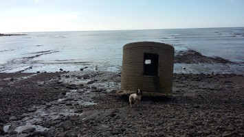
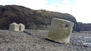
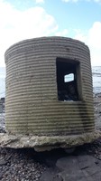
A World War II type 25 pillbox located on the western edge of Gaulter's Gap, Kimmeridge Beach, Kimmeridge. It was constructed in 1940-41 and is built of conglomerate concrete using horizontally placed corrugated iron sheets on a raft of concrete. The roof is of concrete laid on corrugated iron sheeting, which is still in situ. There is also evidence of iron sheeting laid around structure one inch under the external wall surface. A field visit in 1997 found the structure to be in a good condition.
- Period
- Modern (1901 and later)
- Period comments
Constructed 1940-41
- The earliest date of the feature, as a year, if known
- 1940
- The latest date of the feature, as a year, if known
- 1941
- Monument Type - Broad
- PILLBOX (TYPE FW3/25)|PILLBOX
- Monument Type - Narrow
- Monument Description
- Evidence Type - Broad
- Evidence Type - Narrow
- Evidence Description
- Object Type - Broad
- Object Type - Narrow
- Object Description
- Height OD (m)
- How accessible is the feature?
- Easily accessible - no restrictions, Accessible on foot (footpath)
- Accessibility comments
The site is easily accessible from the footpath
Other records:
- NRHE Number
- 1419122
- NT HBSMR Number
- Unknown
- HER Event Number
- Unknown
- External Link
- None
Over to you...
If you know there are errors in the original feature record above, you can edit the original record
If you would like to visit the feature and carry out a 'Feature Update Survey', you can prepare a 'Feature Update Survey' pack for this feature (in PDF format)
If you have completed a 'Feature Update Survey' for this feature, you can submit your 'Feature Update Survey'
If you want to use your smart phone to carry out the 'Feature Update Survey', you can download the CITiZAN smart app.
Feature Update Surveys
1 survey accepted and 0 pending.
Click on a survey to expand it.
- Date of survey
- 23rd February, 2016
- Feature located?
- Yes
- State of the tide
- Low
- Proximity to coast edge
- Intertidal zone
- Coastal processes
- Active sea erosion, Has eroded in the past
- Is there a coastal defence?
- No
- Other threats?
- Visitor erosion, Structural damage/decay, Water erosion (e.g. stream, etc)
- If other, please specify
- How visible are the remains? ABOVE GROUND
- Highly visible (substantial remains)
- How visible are the remains in the face of the cliff, ridge or dune? IN SECTION
- Do you know if the feature is?
- Is well known, Is well visited, Has local associations/history
- What actions (if any) would you recommend for this feature?
The site is leaning considerably and the concrete is visibly eroding, continued monitoring required.
- Do you have any other comments?
Photos
WWII Pillbox Kimmeridge by LTidbury
WWII Pillbox Kimmeridge by LTidbury