The Mersea Timbers: Part One - The Discovery
14/02/2017 | Oliver Hutchinson
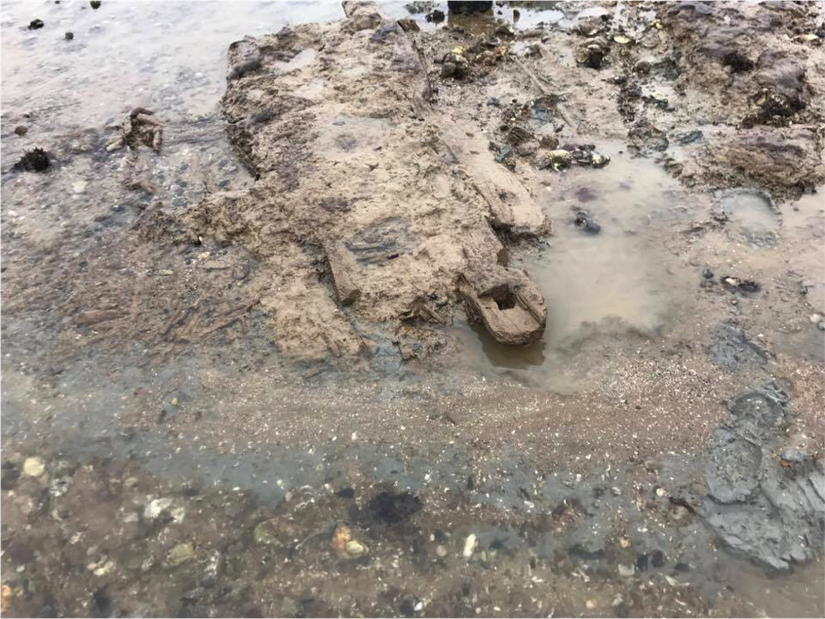
On a cold, clear day between Christmas and New Year of 2016, Mersea oysterman Daniel French made a remarkable discovery on the expansive mud flats on the island’s southern shores. After beaching his boat on the mud he went about collecting oysters from a familiar patch he has worked many times before some 650m offshore. On this occasion however, the mud and silt had shifted and the landscape changed. As a result, he came across a group of three large timbers with square cut sockets in each end resting in a flowing channel. The timbers lay atop a large spread of brushwood that extended a metre to the north and over seven metres to the south into the thick mud. Smaller patches of brushwood, also thick with silt, could be seen resting on top.
Having worked the shores all his life, Daniel has encountered a wide variety of unusual foreshore features. Various timbers, alignments of posts, bits of boats and traffic cones are a regular occurrence, however this find stood out because it was so unique in its shape and size. But what had he found? The image below was taken by Daniel at the moment of discovery. What would you have thought this was?
Initial investigations
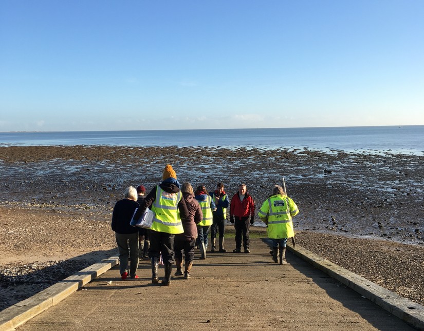
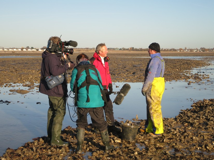
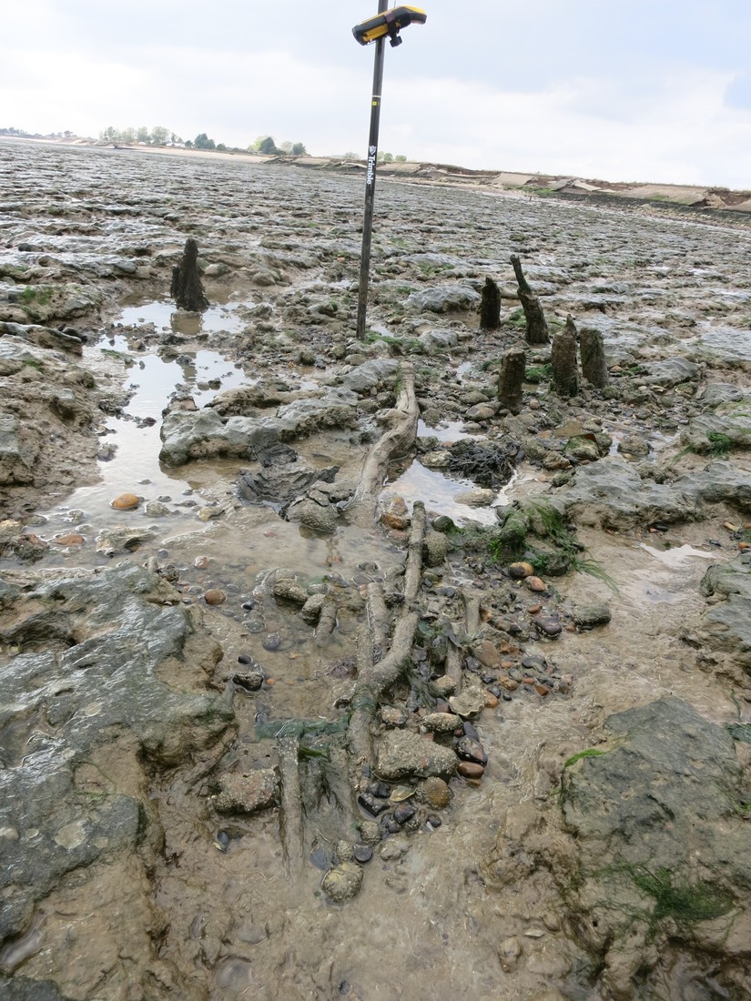
After the CITiZAN team were alerted to the discovery an initial investigation was undertaken in January 2017 to shed light on the mysterious timbers. Comprising Mersea volunteers, CITiZAN archaeologists, County Archaeologist Dr Jess Tipper, Ellen Heppell of ASE and, by sheer coincidence, a BBC Countryfile TV crew, the team trekked across the sticky mud to explore. Led by volunteer Jim Pullen, and using high precision GPS equipment, the team were able to re-locate the timbers on the otherwise featureless landscape.
Given the size, shape and arrangement of the timbers and stakes still pegging them down, the team believed that they were looking at a trackway, very likely prehistoric, and certainly unique to the area. Time was limited so GPS readings were taken on each of the timbers and surrounding stakes so that their location and, crucially, their height above or below sea level could be recorded and fed into a wider site plan of the area back at base. Plenty of photographs were also taken as well as sketch plans and measurements.

The largest timber measures some 2.2m in length and over 0.30m in width. They are all relatively uniform in their depth at about 7cm. The socket holes were also relatively uniform in size at about 3 x 3.5cm. As we would learn later, tool marks from the axes used to cut them were still plainly visible inside the slots. During the trip we also established that these timbers were not alone. A further two timbers were discovered to the north of the original grouping. Both were recorded using GPS along with a number of stakes still sitting where they were driven into the ground, the planks they once pinned down long gone. If these timbers turn out to be from the same structure, and only further analysis and dating can tell us how likely that is, then this trackway was at least 75m in length.
You can watch the moment the team investigate the timbers for the first time on BBC Countryfile Winter Diaries tomorrow morning (Wednesday 15th February) on BBC One at 9:15am
An island beginning to reveal its ancient past
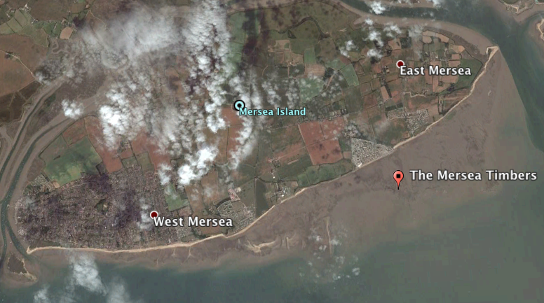
Mersea island is seemingly awash with archaeology. Over the past 18 months CITiZAN has been working with an amazing group of Mersea residents to begin mapping and understanding what lies beneath the shifting shores of this island in the Blackwater. Initially, work focussed on the eastern end of the island but interest soon spread westward towards Coopers Beach. It is here that the mudflats extend far away from dry land, stretching over 900m from the shoreline and, as we are slowly learning, into a long lost landscape.
A myriad of timber structures, posts, wattlework and even prehistoric human remains have been found on the islands shore. The waves are slowly revealing the story of ancient Mersea, but Daniel’s discovery has propelled our understanding forward. What was the community like that lived on and around the ancient Blackwater? Clearly it was large enough to undertake huge engineering projects such as this, the likes of which have not been found anywhere else in the Greater Thames Estuary area. But what of the landscape in which they lived? It too must have been radically different, likely densely wooded with established trees that were used to build the trackway we now know of. As always, the archaeological evidence only raises more questions.
Reports from our volunteers suggest that the foreshore on Mersea is changing rapidly, particularly on the souther shore. In only the last ten years there has been a drop of c.75cm in the levels of the mud at east Mersea revealing the structure captured by Britain At Low Tide during filming. What is the reason for this dramatic change? We don't yet know, but we do need more volunteers like Daniel and the rest of the Mersea team to monitor our foreshores to capture amazing archaeology before it is lost. Who knows what the sea might reveal to you?